Protected Under
Antiquity Act 1975, The Sindh Cultural Heritage (Preservation) Act 1994
25°53'50.5"N 67°54'08.3"E
![]()
On the UNESCO World Heritage Site Tentative List
Antiquity Act 1975, The Sindh Cultural Heritage (Preservation) Act 1994
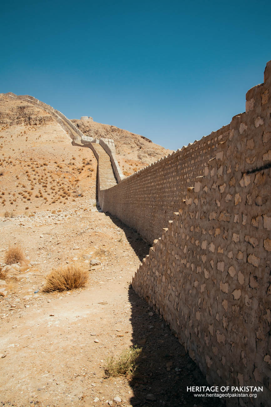
Only about 25% of Ranikot Fort’s 32-kilometer wall is man-made—the rest is formed by the natural cliffs and ridges of the Kirthar mountains.
The Best Time to Visit Sindh Province is Winters. Preferably from September to April Peak Summers (May to August) can get extremely hot with temperatures reaching higher than 40 °C . Hence Summers are not recommended.

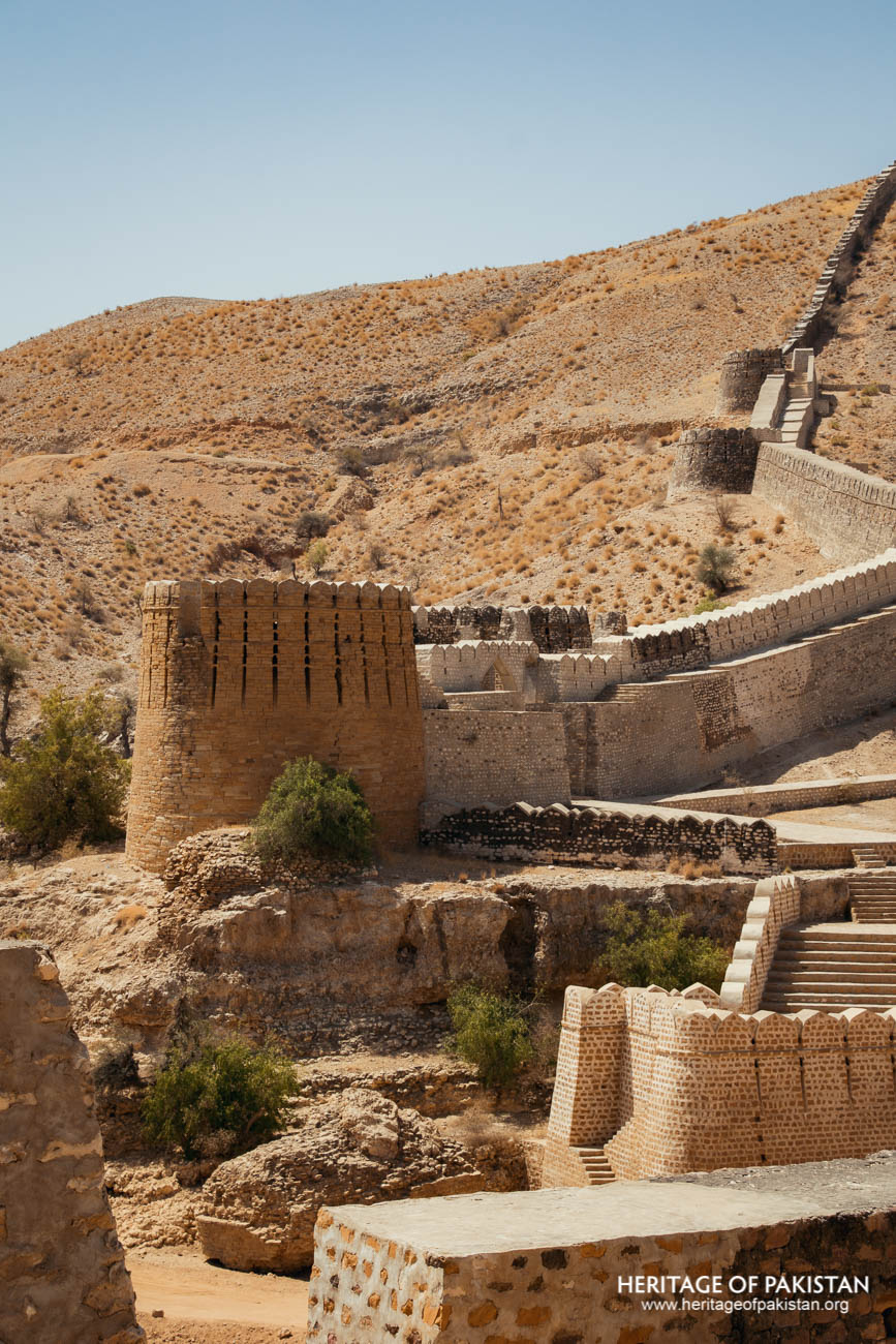
Ranikot Fort, situated in the Jamshoro District of Sindh, is a prominent historical site often associated with the Talpur era. Its considerable scale, with a circumference wall stretching approximately 32 kilometers, has led to frequent references to it as the “largest fort in the world.” It is also colloquially known as the “Great Wall of Sindh,” a title that reflects both its immense size and distinctive architectural presence. The fort lies within the Kirthar mountain range, which marks the boundary between the provinces of Sindh and Balochistan. Rather than being entirely man-made, the fort’s defensive layout integrates both constructed walls and natural features, with the rugged terrain of the Kirthar mountains forming an essential part of its fortification.
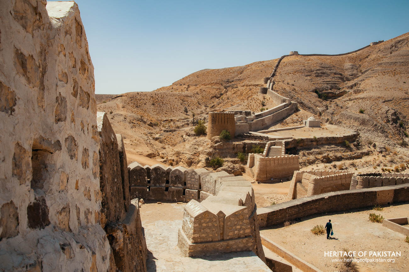
Within the expansive perimeter of Ranikot, there are three smaller forts—Miri Fort, Shergarh Fort, and Mohan Kot—each contributing to the layered defense system of the complex. The fort is accessed via the Indus Highway near the village of Sann, from where a secondary road leads directly to its entrance. It is located roughly 134 kilometers from Hyderabad and about 40 kilometers from Sann.
The fort’s name is closely tied to its natural environment. It derives from a mountain stream, known as ‘Nain Rani,’ that runs through its center. The word ‘Rani’ denotes the natural flow of water, which has led to various historical names such as ‘Rani jo Kot,’ ‘Runne Kot,’ and more commonly, ‘Rani Kot,’ meaning “Fort on the flowing stream.” This seasonal stream gathers water during the monsoon period from the Kirthar Mountains and ultimately drains into the Indus River, highlighting the site’s ecological interconnectedness.
The origins of Ranikot have been the subject of considerable speculation and debate. Various theories have been put forward, as noted by historian Ishtiaq Ansari. Some scholars have proposed that the fort may have been originally constructed by the Scythians or Indo-Greeks between 150 BCE and the beginning of the Common Era. Others place its origins even earlier, suggesting a connection with the Persian Sassanian Empire. Another perspective links it to the Arab administration under the Abbasids, specifically to Imran bin Musa Barmaki, who served as a governor in the region.
Wall and Bastions of Ranikot Fort

Battlements of Ranikot Fort
Despite these alternative views, the most widely accepted theory attributes the fort’s present form to the Talpur Mirs of Sindh. Historical accounts suggest that its construction or significant reconstruction occurred around 1812 AD under the direction of two senior Talpur rulers, Mir Karam Ali Khan Talpur and Mir Murad Ali Khan Talpur. The project was executed under the supervision of Nawab Wali Mohammad Khan Leghari, then Prime Minister of Sindh and an experienced military general with knowledge of engineering and fortification techniques.
While there is a possibility that an earlier structure existed at the site, most interpretations suggest that the Talpurs either built over or substantially restored a pre-existing fortification. The exact purpose behind this undertaking remains uncertain. It may have been intended as a safe haven for the ruling families in times of conflict or to strengthen the western defenses of their territory. Another view suggests that the fort was reconstructed during the early decades of the nineteenth century in response to growing British influence and military pressure, with the aim of creating a refuge for the Talpur leadership in the event of an invasion.
In more recent times, efforts have been made to facilitate public engagement with the site. The Sindh Tourism Development Corporation (STDC) has established a resort and guesthouse at Ranikot, allowing visitors the opportunity to explore the fort and spend the night in its vicinity. These developments reflect a growing interest in preserving and promoting the cultural and historical heritage of the region. In recognition of its architectural and historical significance, Ranikot has been placed on the Tentative List of World Heritage Sites.
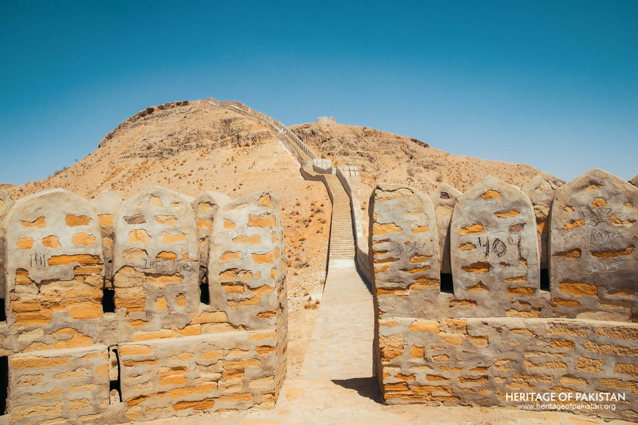
Merlons of Ranikot Fort
Wall of Ranikot Fort, Sindh
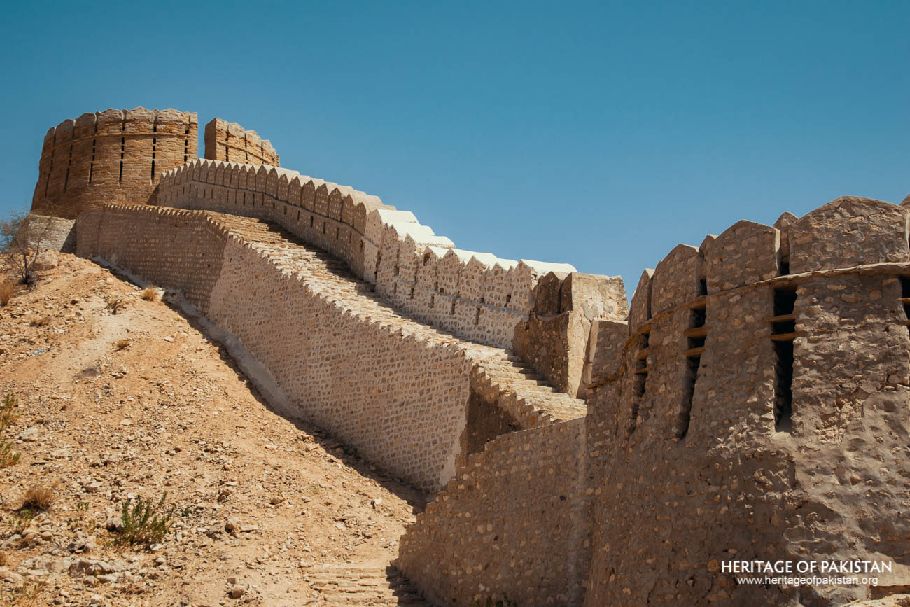
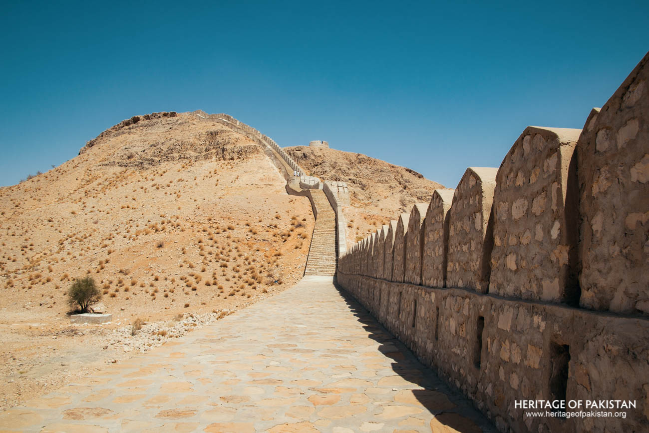
Ranikot Fort stands as a compelling example of fort architecture that integrates both human engineering and the natural landscape. With a circumference wall extending approximately 32 kilometers, the site is often regarded as the largest fort in the world. The wall, constructed using yellowish limestone block masonry, exhibits a blend of functional and defensive design, featuring bastions in semi-circular, circular, and rectangular forms. The average height of this fortification wall reaches about 9 meters. Notably, only around 25% of the perimeter wall is man-made, while the remaining 75% consists of natural barriers such as ridges, steep cliffs, and rocky escarpments. These natural features have been utilized to form part of the fort’s defensive perimeter, reflecting an architectural approach that responds closely to the terrain of the surrounding Kirthar mountain range. The construction material was locally sourced from these mountains, which further reflects the integration of site-specific resources into the fort’s architectural logic.
The fortification wall closely follows the natural contours of the landscape, particularly in areas where the terrain itself offers adequate protection. In some sections, natural ridgelines and vertical cliffs substitute the need for masonry, thereby reducing the extent of artificial construction while maintaining defensive efficacy. The eastern section of the wall, accessed from Sann via the Indus Highway, intersects the bed of a central seasonal stream known as the Rani Nala. This stream becomes active during the monsoon season, carrying rainwater collected from the surrounding hills and ultimately draining into the Indus River. At this location, the remains of an old bridge, once used to span the seasonal watercourse, are still visible. Several other bridges within the fort similarly allow movement across water channels, further indicating the engineers' attentiveness to the hydrology of the area.

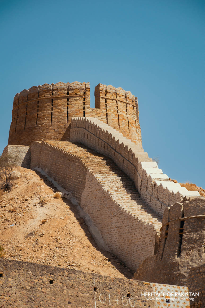
View of Bastion and Wall
According to Ishtiaq Ansari, Ranikot Fort has two principal gates: the Sann Gate to the east and the Mohan Gate to the west. The Sann Gate, which serves as the primary access point from the Indus Highway, is fortified with substantial bastions. Adjacent to this entrance is a small domed structure, which may have functioned as a mosque. From the Sann Gate, a road leads into the fort and eventually connects with its internal elements, offering a sense of how movement through the complex was organized.
Within the outer enclosure of Ranikot are three smaller forts—Miri Kot, Shergarh Fort, and Mohan Kot—each serving distinct strategic purposes. Miri Kot is located near the center of the larger fort and lies approximately five kilometers from the Sann Gate. It was used as a royal residence by the Talpur Mirs and features living quarters designed for sustained habitation. Triangular in plan, with one broad and one narrow side, Miri Kot is equipped with five defensive bastions. The gate is located on the broader side, and the interior includes various domestic spaces that indicate its residential character.
Shergarh Fort is positioned atop a hill and appears to have been designed solely for military purposes. Unlike Miri Kot, no evidence of living quarters has been found at Shergarh, suggesting its function was primarily defensive, likely intended as a last line of resistance during a siege. The elevation would have offered a strategic vantage point, making it an effective position for surveillance and control of surrounding terrain.
The third fort, Mohan Kot, is situated on the western side of Ranikot. While less is documented about its specific function, its placement aligns with the broader strategic logic of the fort, contributing to a defensive system that combines residential, military, and geographic elements.
Taken together, Ranikot Fort exemplifies a defensive architecture deeply responsive to its natural environment while also fulfilling the social and military needs of the Talpur rulers. Its combination of artificial and natural fortifications, varied internal structures, and strategic use of terrain suggests a complex and adaptive architectural vision.
All Photographs by Syed Noor Hussain and Sania Azhar.
All Rights Reserved. Photos may be used for Non-Commercial, Educational, Artistic, Research, Non-Profit & Academic purposes.
Commercial uses require licensing agreement.
Syed Noor Hussain
July 23, 2025 at 2:15 amInteresting place