Did You Know?
Satpara lake and its stream provides the water for the Skardu Valley
35°14'12.1"N 75°38'11.0"E
Satpara lake and its stream provides the water for the Skardu Valley
The Best Time to Visit Gilgit Baltistan Region is Summers. Preferably from April to September. Winters are Extremely Cold and Snowfall blocks most of access. Hence Winters are not recommended.

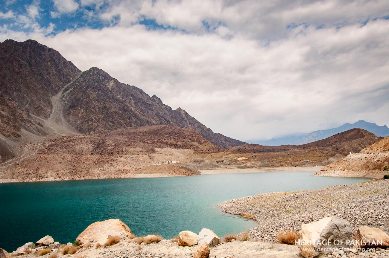
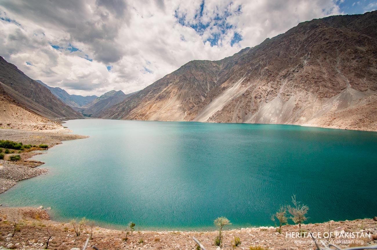
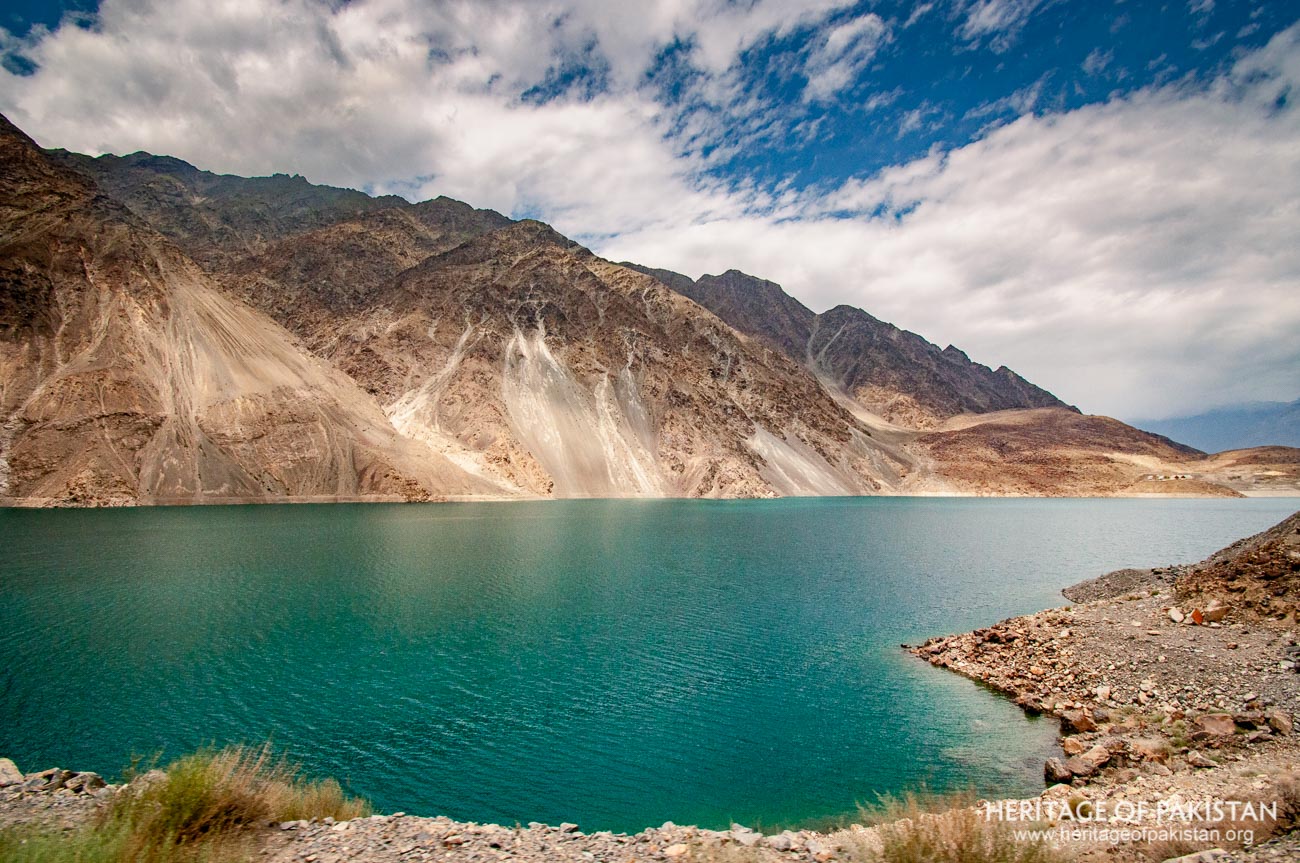
Satpara Lake, located approximately 24 km south of Skardu at an altitude of 2661 meters, is an important and beautiful lake in the Skardu region. The lake is elongated and confined between two parallel mountain ranges that run in along with the road leading to the Deosai National Park. The principal water source for Satpara Lake is the Satpara Stream coming from the Deosai Plains, which also serves as a significant supplier of water to the city of Skardu.
Constructed on this lake is a dam, which plays a crucial role in providing electricity and water for the surrounding areas. The lake exhibits a visually distinct emerald coloration which makes it a treat to photograph. The name of the lake is attributed to its geographical proximity to the Satpara Village, lying further Southward of the Lake.
Satpara Lake's origins, as per Ahmad Hassan Dhani's, are believed to coincide with the Tibetan epoch of Skardu, implying an historical longevity to its existence. Dhani contends that the formation of the lake was facilitated by the construction of a dam on the stream during the Tibetan Buddhist period and the excavation of an irrigation channel at the same time. Interestingly, in the nearby region of Manthal, archaeological excavations have revealed Buddhist remains, further consolidating the lake's historical significance during the Tibetan era.
Despite these historical inferences, some accounts attribute the construction of the lake to Ali Sher Anchan of the Makpon Dynasty. Evidently, when the Mandok Fort was erected in Skardu by Ali Sher's Ladakhi Queen, Mandok Gyalmo, a Mughal-style garden was also developed within the fort premises. To irrigate this garden, a stone water channel, the remains of which can still be observed, was constructed to transport water from Satpara Lake.
Preceding its modern infrastructure, an earth-fill dam, reportedly constructed by Ali Sher Anchan, the famous local Skardu Raja, was located downstream of the lake. However, this dam succumbed to a breach around 1880, and subsequently, local farmers erected a 4-foot high stone bund downstream of the lake. This bund served a critical role in storing approximately 1300 AF of water for the cultivation of Rabi crops.
In a later attempt at restoration in 1976, the Northern Area Works Organization (NAWO) undertook the partial reconstruction of the breached dam, additionally installing an outlet sluice slightly below the lake's existing level. Regrettably, this initiative failed to achieve its intended utility due to excessive seepage, thereby emphasizing the need for further research and development in the dam's structural design.
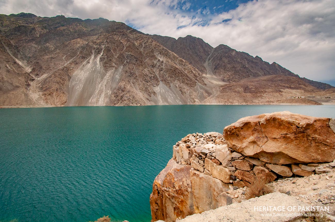
Situated in the Karakoram range, Satpara Lake is located on the southern side of the Skardu valley. At an elevation of 2661m or 8730 feet above sea level, the lake's formation can be traced back to glacial activity wherein the progression of glaciers dammed the flowing Nallah, consequently facilitating its formation. However, other traditions attribute the creation of the lake by human intervention. Satpara Lake extends over an area of approximately 2.1 square kilometers, with its length measuring around 3 kilometers, and its width at the widest point, about 1 kilometer. The lake has significant ecological value for the nearby areas. An additional intriguing feature of the lake is a small island in it. Satpara Lake is also integrally linked to the Indus River system through the Satpara stream,which is a tributary of the Indus River.
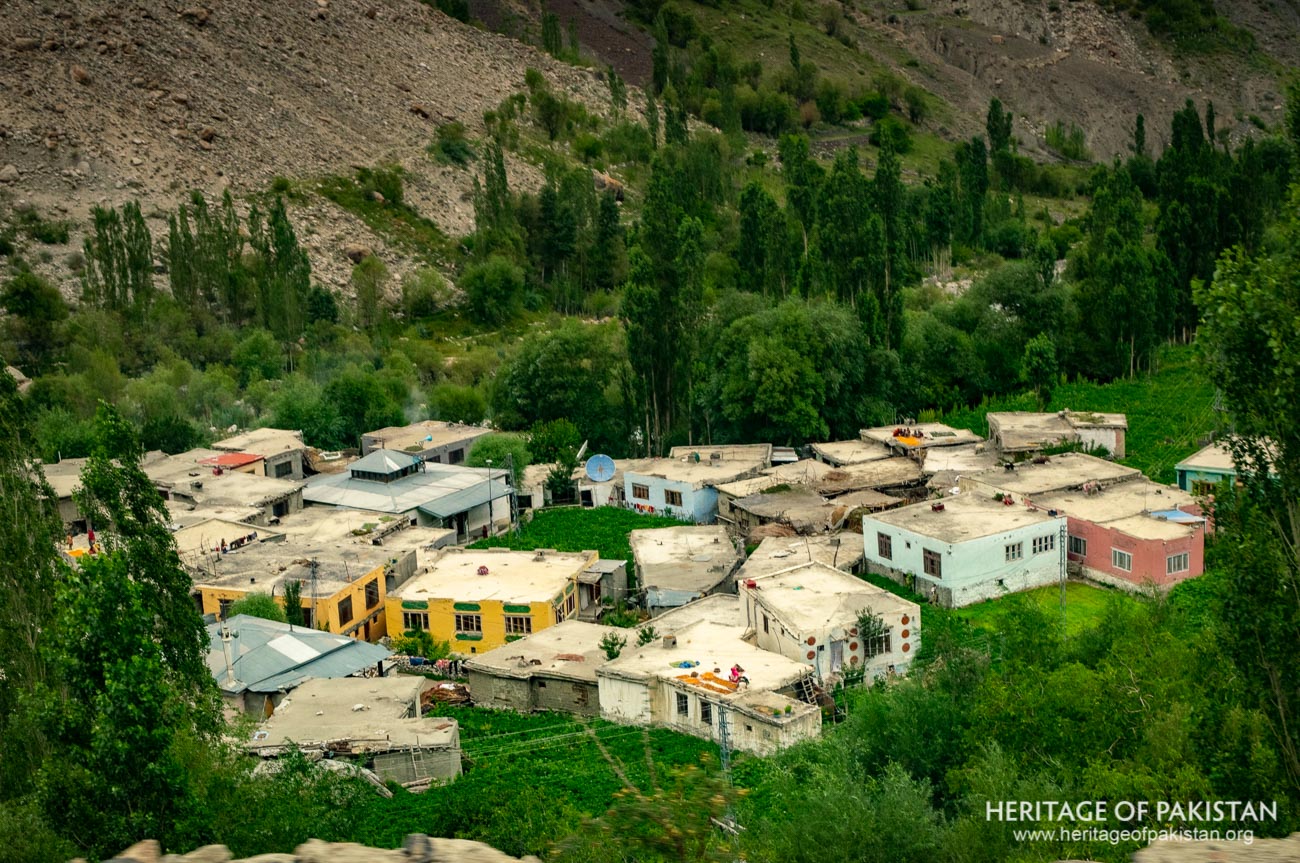
Satpara Lake is characterized by its geographical proximity to the Satpara village, located on the southern extremity of the lake. The lake derives its nomenclature from this neighboring village, indicating an inherent connection with the local culture and community. Further to the south of Satpara Lake, one can locate the Deosai National Park, the second-highest plains in the world, and a refuge of diverse wildlife and biodiversity. The lake's water supply predominantly originates from the melting snows of the Deosai plains, through the Satpara stream which replenishes it with its hydrological cycle.
Satpara Lake holds a significant cultural connection to the nearby Satpara village from which it inherits its name. The village of Satpara is known for its contribution to the field of high-altitude mountaineering in Pakistan, providing a lineage of skilled mountaineers who have etched their names in the annals of history.
A poignant example of this legacy is Ali Sadpara, a renowned mountaineer hailing from this village. His fateful expedition in 2021 led to his unfortunate death on the formidable K-2, making his indelible mark on the mountaineering scene in Pakistan. The lineage of mountaineering excellence continues with his son, Sajid Sadpara, who has also embarked on a career as a high-altitude mountain climber, maintaining the family's tradition of challenging the rugged terrains of the Himalayas.
The Satpara Lake has been the focal point of an important infrastructural project initiated in 2003. Funded by the United States Agency for International Development (USAID), this project involved the construction of a dam downstream of the lake with the principal objective of local hydroelectric power generation.
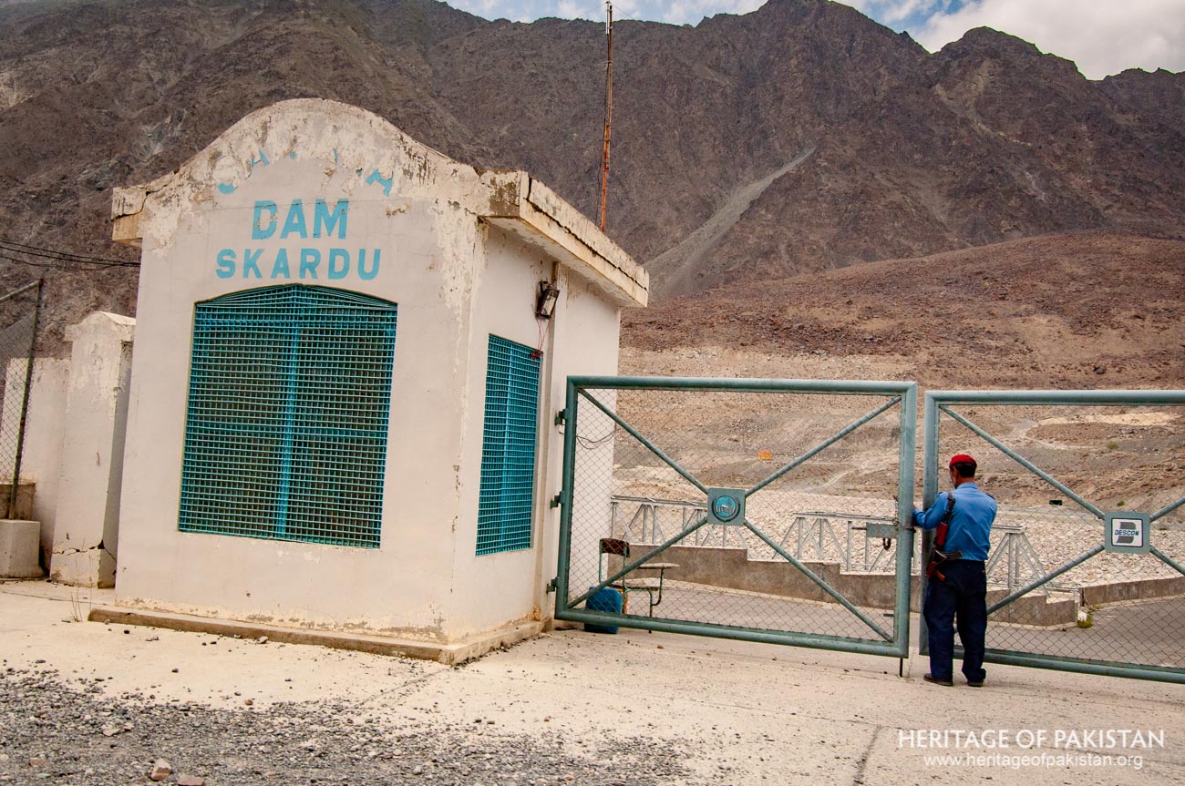
Once operational, this dam is projected to contribute approximately 17.6 Megawatts to the regional electricity grid, effectively providing a continuous power supply to an estimated 40,000 households. This substantial increase in the production of renewable energy underscores the dam's potential as a pivotal component of the region's power infrastructure.Moreover, this dam's multifaceted utility extends beyond energy production, mitigating regional flooding. The dam also serves as a strategic water reservoir, retaining sufficient volumes to irrigate downstream land, thereby significantly enhancing agricultural productivity within the region.Another pivotal aspect of this project is its contribution to the provision of potable water for Skardu city. With the capacity to provide 3.1 million gallons per day for domestic use, the dam significantly improves the city's water accessibility.
The project encompasses several major components including an earthfill Dam, four powerhouses, and two irrigation canals. Once fully operational, these irrigation systems are expected to service approximately 15,000 acres of land, further cementing the project's multifaceted utility and its role in socio-economic development within the Skardu Valley.
All Photographs by Syed Noor Hussain and Sania Azhar.
All Rights Reserved. Photos may be used for Non-Commercial, Educational, Artistic, Research, Non-Profit & Academic purposes.
Commercial uses require licensing agreement.
Syed Noor Hussain
July 23, 2025 at 3:45 amBest