Did You Know?
The Naltar Lakes are fed by the glacier of Shani Peak, which also gives rise to the Naltar River
36°13'55.1"N 74°06'25.0"E
The Naltar Lakes are fed by the glacier of Shani Peak, which also gives rise to the Naltar River
The Best Time to Visit Gilgit Baltistan Region is Summers. Preferably from April to September. Winters are Extremely Cold and Snowfall blocks most of access. Hence Winters are not recommended.

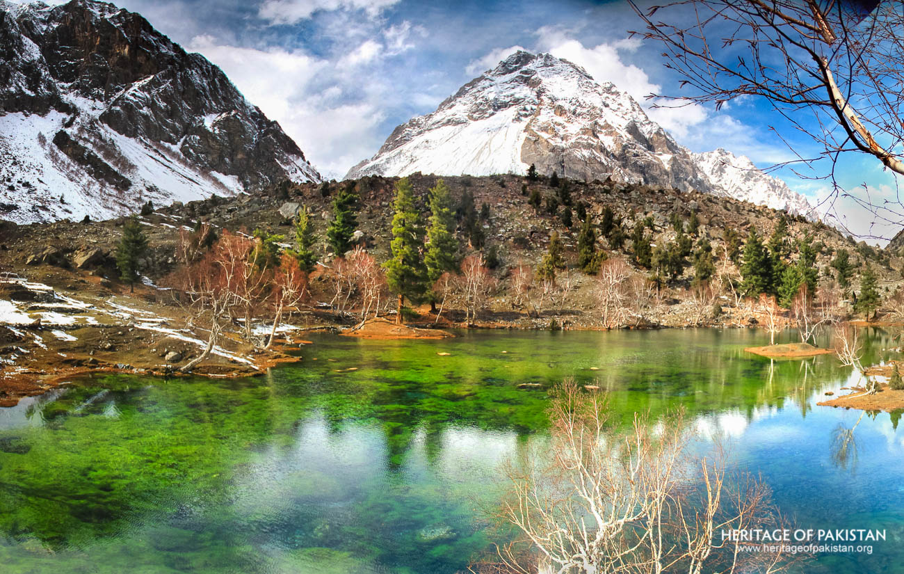
Naltar Valley, situated in Gilgit-Baltistan, is a remarkable alpine region known for its dramatic landscapes, colorful lakes, and high-altitude terrain. Located 44 kilometers from the city of Gilgit, the valley rests at an elevation of 2,898 meters above sea level within the Karakoram mountain range. The total area of the valley spans 27,206 hectares, with altitudes ranging from 1,700 to 5,000 meters. Naltar is positioned northwest of Gilgit Valley and southwest of the Hunza region. The valley is one of Pakistan’s two skiing destinations—the other being Malam Jabba in Swat—and is home to the country’s oldest ski resort.
Geographically, Naltar Valley is divided into two main sections based on elevation: Naltar Payeen (Lower Naltar) and Naltar Bala (Upper Naltar). Naltar Payeen lies close to Nomal and serves as the entry point into the valley, encompassing villages such as Mominabad and Mehdiabad. Naltar Bala, where the valley opens up, hosts most of the settlements and scenic features, including the lakes and high-altitude peaks. The valley is long and stretches from its northwestern boundary at Naltar Pass, where the Shani Peak and its glacier dominate the horizon, to the southeastern edge near Nomal where the Naltar River merges with the Hunza River.
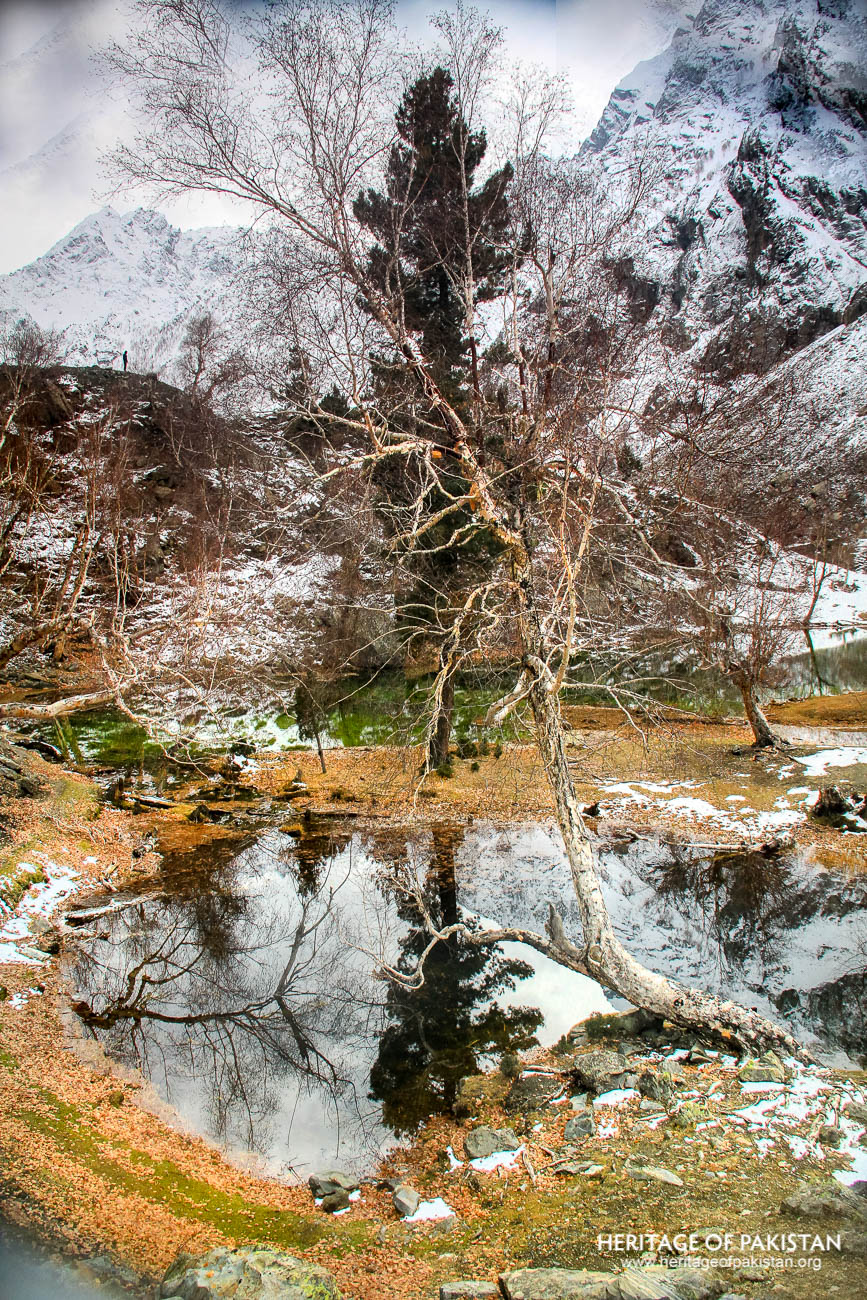
Naltar Valley has a mixed landcover consisting of conifer forests, permanent snow, glaciers, peatlands, grass meadows, rocks, wetlands, and cultivated agricultural areas. The harsh winters see temperatures falling as low as -18°C. Agricultural activity is prevalent around the settlements, with potatoes cultivated extensively, along with fruits such as apricots, cherries, apples, and walnuts.
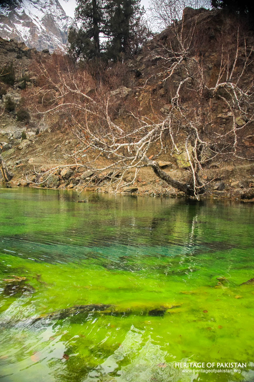
A defining feature of Naltar is its collection of glacial lakes, commonly referred to as the Naltar Lakes or Bishkiri Lakes. These lakes are glacier-fed, formed by the meltwater from Shani Peak and its surrounding glacier. They are situated beyond Naltar Bala and are notable for their vivid colors and striking natural beauty. A glacial lake forms when meltwater from a glacier accumulates in a depression created by glacial erosion or is dammed by ice or moraine. Naltar's lakes are classic examples of this phenomenon.
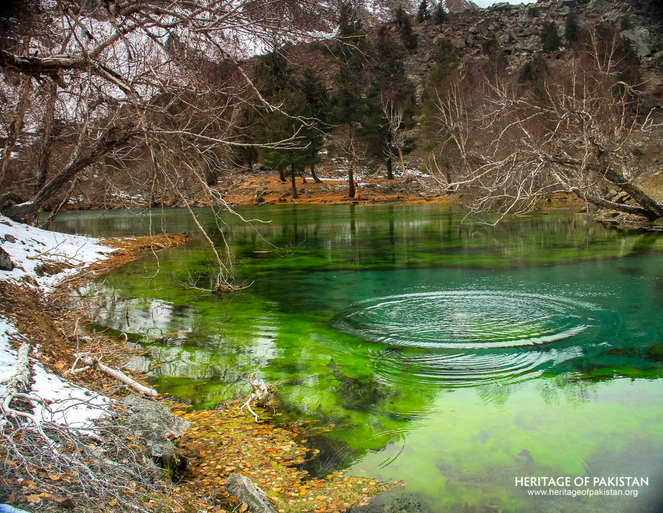
The Naltar River originates from these lakes and traces its course through the valley until it converges with the Hunza River near Nomal. Among the most celebrated lakes is the Satrangi Lake, also known as Bishkiri Lake I or Bishkisi Lake I. The term “Satrangi” refers to its seven distinct hues, caused by the growth of moss and underwater vegetation. This lake covers an area of 21,000 square meters and lies about 12 kilometers from Naltar Bala. A Gilgit-Baltistan Public Works Department Rest House is located at the lake’s edge, and access requires a 4x4 jeep.
Roughly one kilometer from Satrangi Lake lies the Blue Lake, or Bishkiri Lake II, named for its deep bluish tint. It spans an area of 36,163 square meters. Nearby, seasonal lakes can also form due to variations in glacial melt and river flow. Another kilometer upstream is the Feroza Lake, also known as Bishkiri Lake III. Named for its turquoise color—‘Ferozi’ in Urdu—it sits on the western bank of the Naltar River and covers approximately 5,000 square meters. Feroza Lake is accessible via trekking from the Blue Lake.
The fourth lake in the group is Bodlok Lake, also referred to as Murky Lake or Milky Lake. It is the largest among the Naltar lakes, with a surface area of 243,053 square meters. Located 1.3 kilometers west of Blue Lake, Bodlok Lake is characterized by a desaturated, murky hue that gives it its name. It is also accessible by foot from Blue Lake.
The Naltar Lakes form a cohesive glacial system, fed by the melting snow and ice from Shani Peak and its glacier. This system not only gives rise to the Naltar River but also shapes the valley’s hydrology and ecology. With its breathtaking scenery, diverse landforms, and cultural importance, Naltar Valley stands as one of Pakistan’s most remarkable natural landscapes.
All Photographs by Syed Noor Hussain and Sania Azhar.
All Rights Reserved. Photos may be used for Non-Commercial, Educational, Artistic, Research, Non-Profit & Academic purposes.
Commercial uses require licensing agreement.
Add a review