Did You Know?
Arang Kel lies near the Line of Control between India and Pakistan
34°48'18.9"N 74°20'47.8"E
Arang Kel lies near the Line of Control between India and Pakistan
The Best Time to Visit Azad Kashmir Region is Summers. Preferably from April to September. Winters are Extremely Cold and Snowfall blocks most of access. Hence Winters are not recommended.

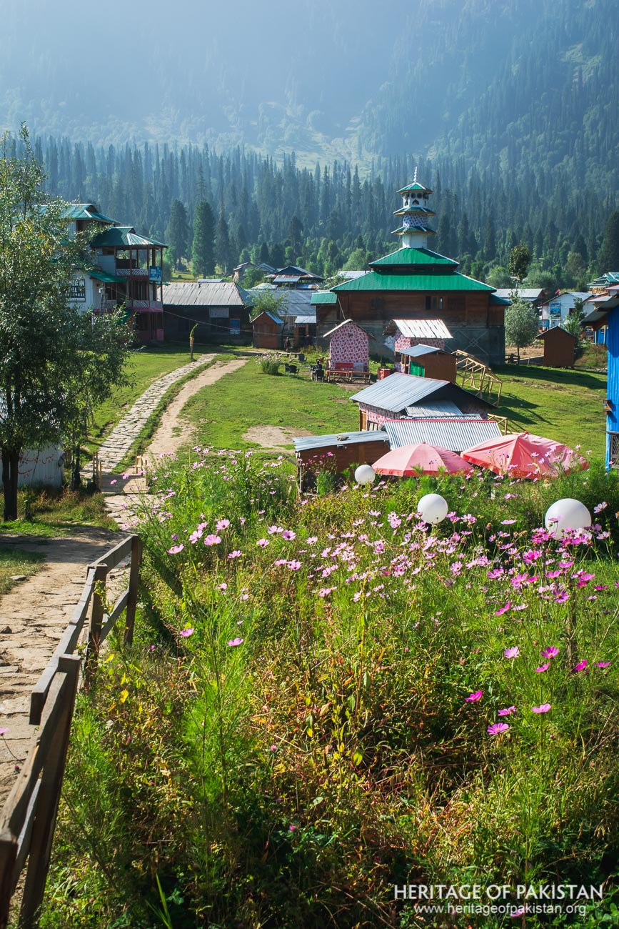
Arang Kel is a traditional kashmiri village and hill station in Neelum Valley, Azad Kashmir, situated at an elevation of 2,381 meters (7,812 feet) above sea level. It lies approximately 150 km from Muzaffarabad, the capital of Azad Kashmir, and is located near the Line of Control between Pakistan and India.
The Arang Kel village is located on a mountaintop across the Neelum river from Kel and can be accessed either by a chairlift or a trekking route. The trek begins with a descent from Kel to the riverbank, where a suspension bridge provides passage across the width of the Neelum river. From there, a steep ascent through a dense forest leads to Arang Kel. The journey is visually stunning, offering breathtaking views of the valley, but the climb is physically demanding and not suitable for inexperienced trekkers.
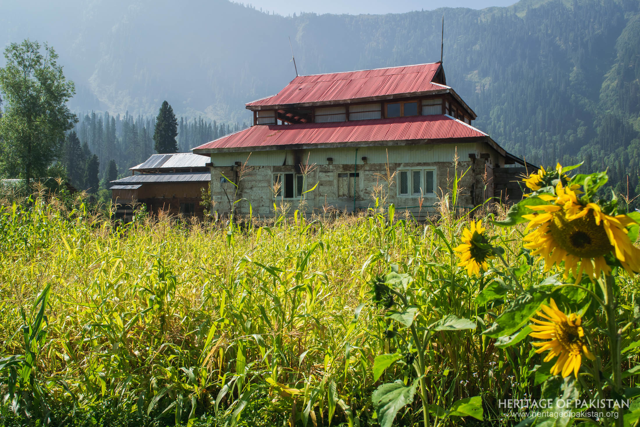
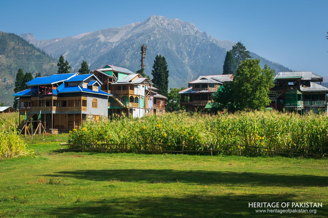
Arang Kel is known for its distinctive indigenous architecture, featuring traditional Kashmiri timber houses built in a characteristic style that has been preserved for generations. The local economy is based on agriculture, with corn as the primary crop, while sunflowers add to the village’s natural charm. A prominent feature of Arang Kel is its traditional Kashmiri style mosque, constructed with a square base and a pyramidal roof, reflecting the region’s architectural heritage. The village also has a school providing education for both boys and girls.
With the increasing influx of tourists, several lodges and hotels have been developed in both Arang Kel and Kel, offering accommodation to visitors. Small eateries serve local cuisine, providing an authentic experience. As tourism continues to grow, Arang Kel remains an enchanting destination, offering a peaceful retreat in the heart of Neelum Valley and making it an ideal place for an overnight stay.
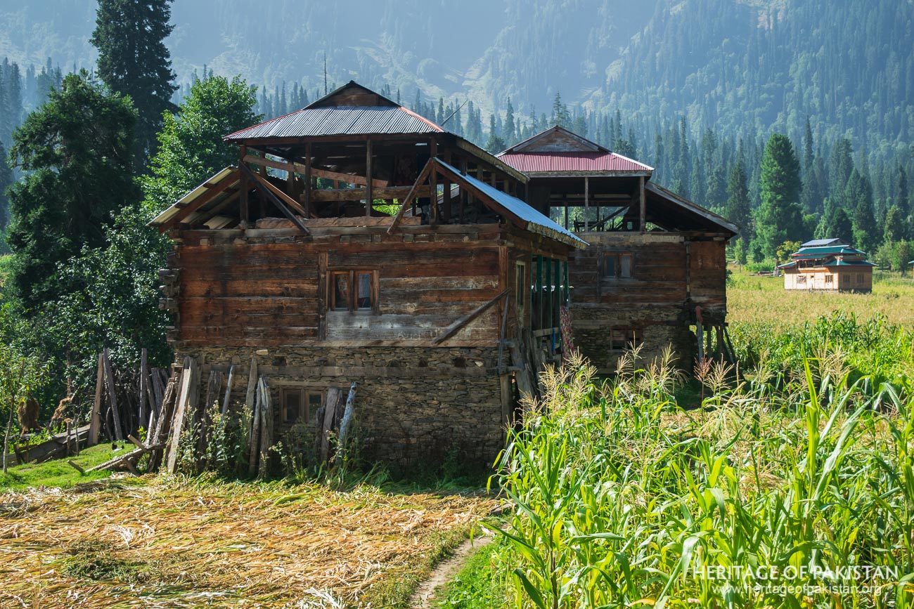
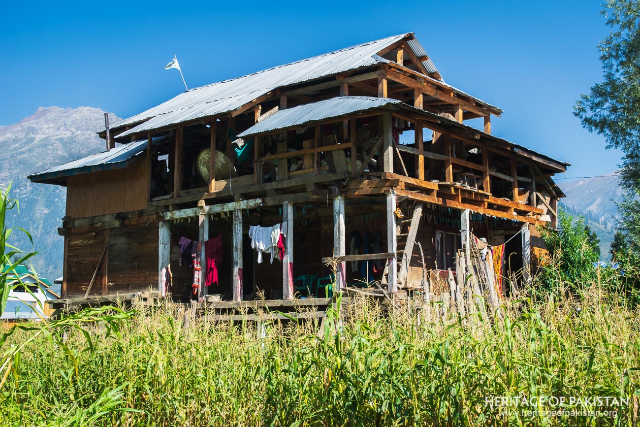
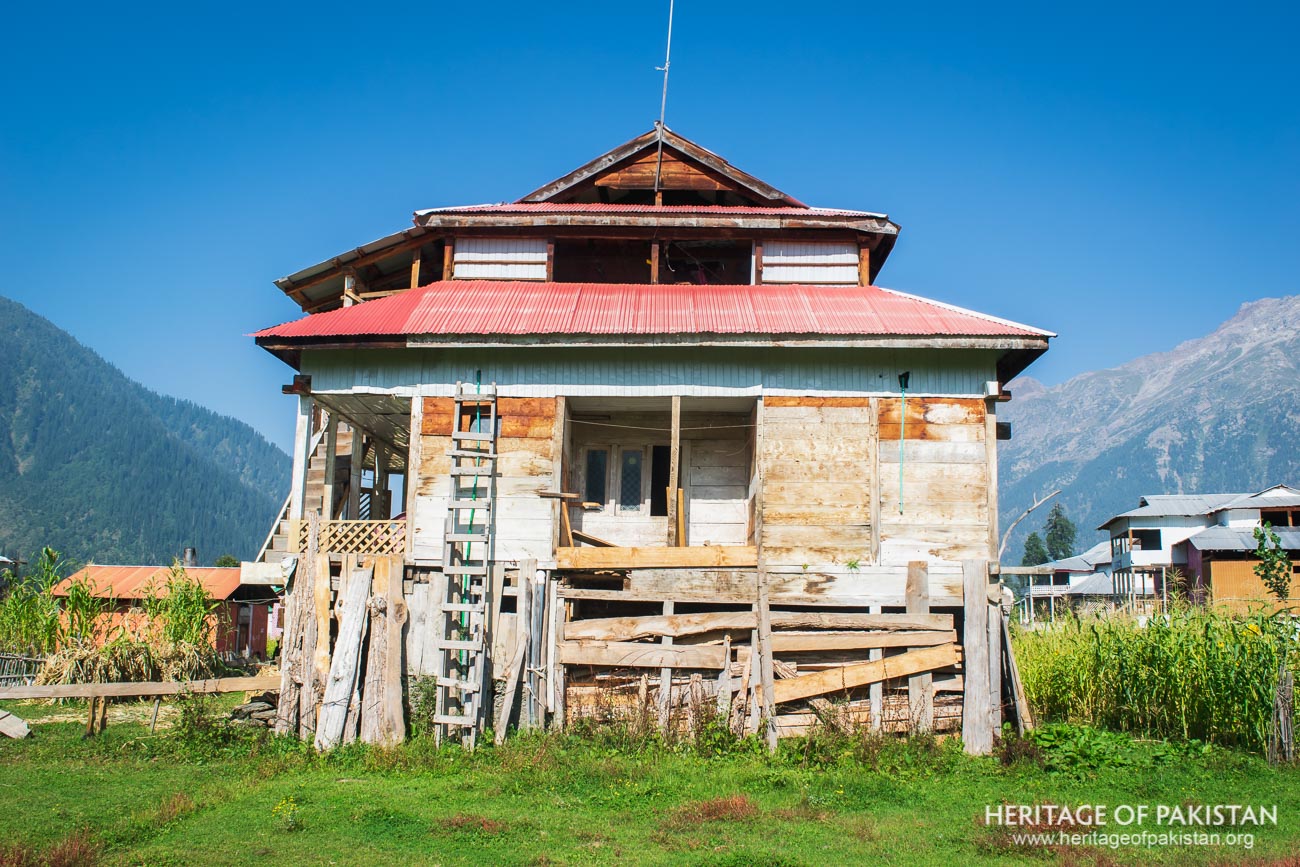
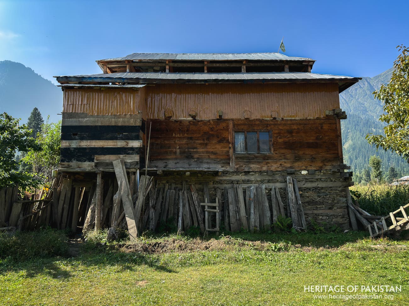
Arang Kel is known for its traditional Kashmiri architecture, where vernacular wooden houses still stand, reflecting the region’s rich heritage. These houses are primarily constructed using timber, mud, and stone, though modern alterations have replaced the original wooden roofs with corrugated tin sheets. However, some older structures still retain their wooden roofs, preserving the authenticity of the village’s architectural character.
The houses in Arang Kel are generally large, multi-story structures, typically consisting of three levels: the ground floor, the main living area, and the attic. The ground floor serves as a storage space and shelter for livestock, where fodder and excess timber are also kept. The first floor functions as the primary living space, housing bedrooms, a kitchen, and communal areas. Above this, the attic is a versatile space used for storage or other domestic purposes.
A traditional mosque in Arang Kel further exemplifies the architectural style of Kashmir and Northern Pakistan. Built with a square base, its structure rises into a pyramidal elevation, a hallmark of regional design. The mosque’s form and construction techniques reflect the cultural continuity of Kashmiri and northern architectural traditions.
Neelum Valley, located in the Western Himalayas of Azad Kashmir, is known for its beautiful mountain landscape, and the Neelum River that flows through its length. Arang Kel is located at an altitude of 2,381 meters (7,812 feet) above sea level and experiences a temperate summer and harsh winters. Heavy snowfall during the winter months often renders the Upper Neelum region inaccessible due to blocked roads and extreme weather conditions.
The best time to visit Arang Kel is between May and September, when the weather is mild, and the area remains fully accessible. During this period, temperatures range from 10°C to 25°C, making it ideal for outdoor exploration. In contrast, winters are severe, with temperatures frequently dropping below freezing and snowfall accumulating several feet, transforming the landscape but limiting access to the region.
All Photographs by Syed Noor Hussain and Sania Azhar.
All Rights Reserved. Photos may be used for Non-Commercial, Educational, Artistic, Research, Non-Profit & Academic purposes.
Commercial uses require licensing agreement.
Add a review