Did You Know?
Attabad Lake was formed overnight in 2010 after a massive landslide blocked the Hunza River
36°18'26.4"N 74°49'28.8"E
Attabad Lake was formed overnight in 2010 after a massive landslide blocked the Hunza River
The Best Time to Visit Gilgit Baltistan Region is Summers. Preferably from April to September. Winters are Extremely Cold and Snowfall blocks most of access. Hence Winters are not recommended.


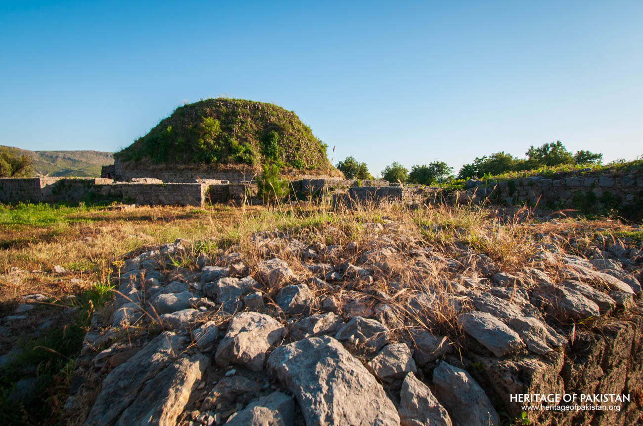
Dharmarajika Stupa, Taxila, Punjab
Attabad Lake is a scenic lake situated in the Gilgit-Baltistan region of Pakistan, within the rugged terrain of the Karakoram mountain range. Geographically located in the Upper Hunza, also known as the Gojal region of Hunza District, the lake lies approximately 15 kilometers north of Karimabad. It derives its name from the village of Attabad, which marks the southernmost point of the lake, while its northern end reaches the village of Gulmit. The lake spans a length of 15 kilometers, originating near Attabad village, passing by Shishkat, and extending up to Gulmit. Further north lie the Passu Glacier and the distinctive Passu Cones, mountains renowned for their sharp, conical peaks. Approximately 140 kilometers from the lake is the Khunjerab Pass and its adjacent Khunjerab Gate, marking the border between Pakistan and China. The lake is recognized for its striking turquoise-blue water, which has contributed significantly to its growing popularity.
Attabad Lake came into existence in 2010 as the result of a natural disaster. On 4th January 2010, a massive landslide occurred near Attabad village, effectively blocking the flow of the Hunza River. The blockage caused the river to swell and form the lake. The disaster had devastating consequences—nearly 20 people lost their lives, and approximately 6,000 residents were displaced. Several villages were either fully or partially submerged under the newly formed lake. In addition, a 24-kilometer stretch of the Karakoram Highway (KKH) was engulfed by the landslide and the resulting body of water.
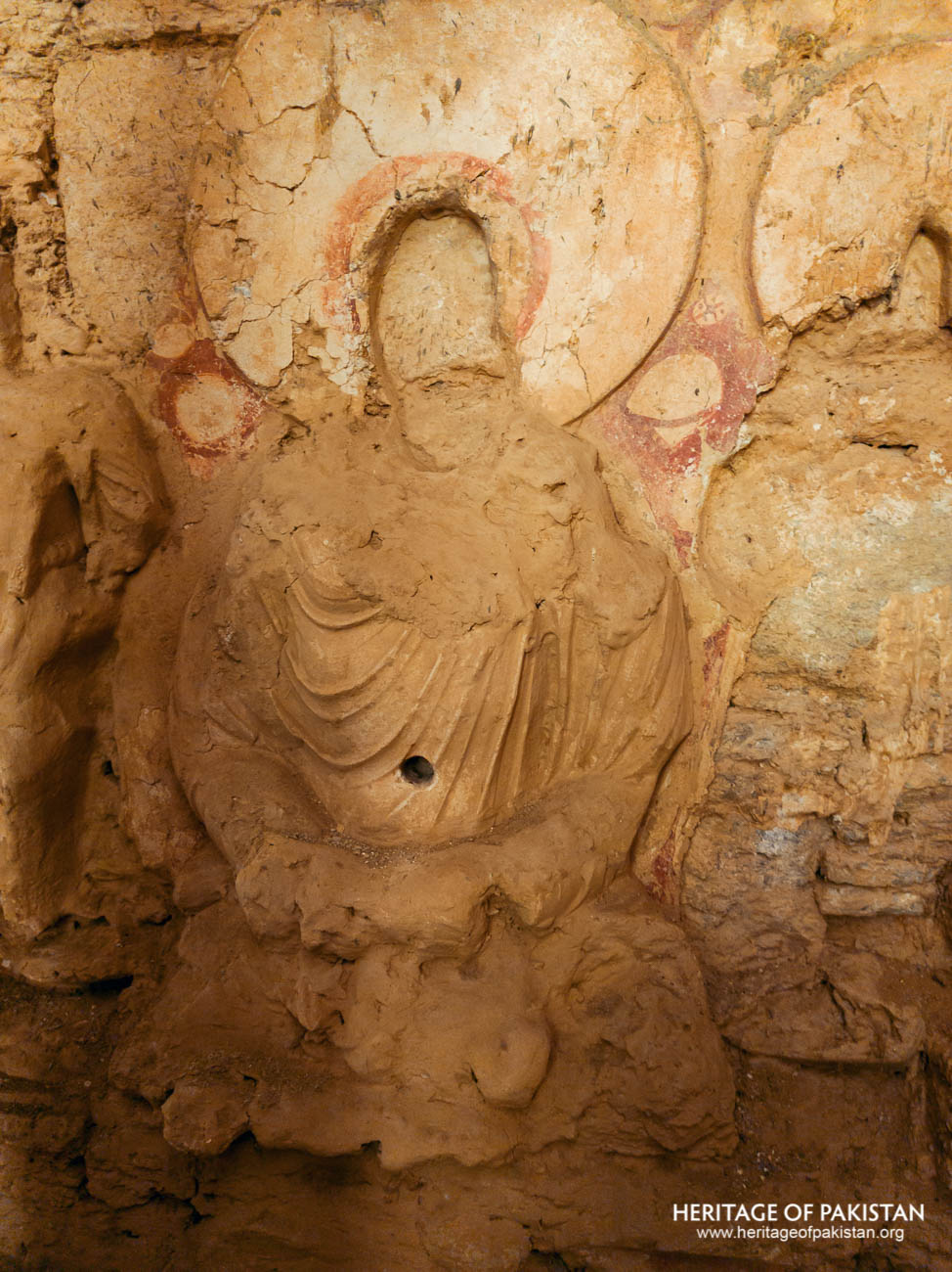 Buddhist Relief Sculpture in Mohra Moradu, Taxila
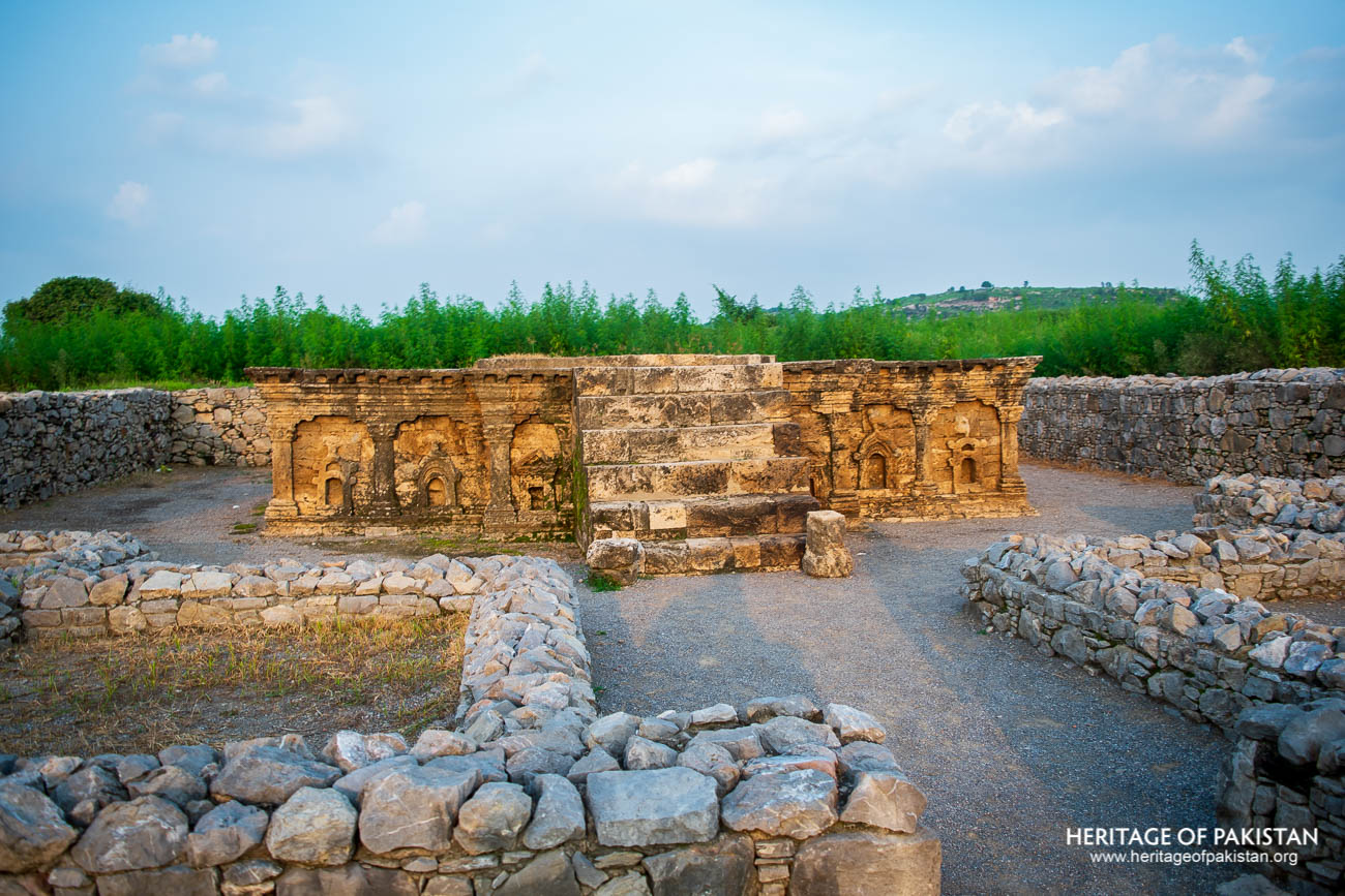
Shrine of Double Headed Eagle, Sirkap, Taxila
For several years following the disaster, the lake disrupted regional connectivity. The Upper and Lower Hunza valleys were only linked via boats, which became the primary mode of transport. Trucks carrying freight from China or heading north from other parts of Pakistan had to halt at either edge of the lake. Goods were unloaded, transferred by boat across the lake, and reloaded onto other vehicles on the opposite side. Local residents similarly relied on boat transport for their daily commute between the two ends of the valley.
To resolve the transport disruption, the National Highway Authority of Pakistan, in collaboration with Chinese engineers, undertook the construction of five tunnels and new sections of road. Completed in 2015, the project restored the Karakoram Highway after a construction period of three years and two months. The restored route reconnected the isolated regions and facilitated the revival of trade and travel through this vital corridor.
In the years since, Attabad Lake has transformed from a symbol of tragedy into one of the most prominent tourist attractions in Gilgit-Baltistan. With its stunning natural backdrop, the lake has become a favored destination for both domestic and international travelers. A number of resorts have emerged around the lake, offering accommodation and recreational services. Tourists can now enjoy a range of leisure activities at the lake, including boating, jet-skiing, fishing, and other water sports, all set against the dramatic mountain landscape of northern Pakistan.
All Photographs by Syed Noor Hussain and Sania Azhar.
All Rights Reserved. Photos may be used for Non-Commercial, Educational, Artistic, Research, Non-Profit & Academic purposes.
Commercial uses require licensing agreement.
Add a review