Did You Know?
Abbottabad was named after Major James Abbott, who wrote a farewell poem for the city after his departure
34°10'20.0"N 73°12'55.2"E
Abbottabad was named after Major James Abbott, who wrote a farewell poem for the city after his departure
The Best Time to Visit mountain regions of Khyberpakhtunkhwa is Summers. Preferably from April to September. Winters are Extremely Cold and Snowfall blocks most of access. Hence Winters are not recommended.

Abbottabad is a city and hill station located in the Khyber Pakhtunkhwa province of Pakistan. Nestled in the Lesser Himalayas, it stands at an elevation of 1,235 meters (4,052 feet) above sea level. Known for its picturesque scenery and temperate climate, the region experiences pleasant summers and moderately cold winters, occasionally accompanied by snowfall. Two major rivers, the Haro and Dor, flow through the district, contributing to its natural charm.
Historically, the broader Hazara region, of which Abbottabad is a part, has witnessed a succession of rulers and empires. In 327 BCE, during his incursions into the Indian subcontinent, Alexander the Great passed through the area and handed control over to Raja Abisaras, the ruler of Poonch. Following Alexander’s retreat, the region came under the Mauryan Empire. Ashoka, the Mauryan emperor and grandson of Chandragupta Maurya, governed this region, spreading the influence of Buddhism. Notably, Ashoka’s edicts have been discovered on Bareri Hill near Mansehra, indicating his rule and religious patronage.
During the 2nd century CE, Raja Risallu gained control over Hazara. In the 7th century, the Chinese pilgrim Hiuen Tsang traveled through the region and recorded that it was then governed by the Kashmiri ruler Raja Durlabha Vardhana. Subsequently, the region came under the sway of the Hindu Shahi dynasty. One of their prominent rulers, Raja Jayapala, suffered defeat at the hands of Mahmud of Ghazni in the Battle of Peshawar in 1001 CE. Although Mahmud Ghaznavi established loose control over the region, it later experienced governance under a series of rulers, including various Kashmiri dynasties.
From the mid-18th to mid-19th century, Hazara remained a part of the Afghan Durrani Empire. The decline of the Durranis led to the ascendancy of the Sikh Empire, which held dominion over Hazara until the British annexation following the Second Anglo-Sikh War in 1849. After their victory, the British established administrative control over the region, and Major James Abbott was appointed as the first Deputy Commissioner of Hazara District in March 1849, serving until April 1853 (Watson, 1907).
Major Abbott played a pivotal role in the establishment of the city that would later bear his name. In 1853, a British garrison was founded in the area, and the headquarters of Hazara District were moved from Haripur, then a Sikh administrative center, to this new location. The decision to choose this site was made by Major Abbott himself, and it was formally named “Abbottabad” by his successor, Major H.B. Edwards, in the same year. According to the Gazetteer of the Hazara District 1883–84, Abbottabad had, by then, evolved into a tehsil and was described as a small town with a population of 1,371 inhabitants.
Abbottabad held a special place in Major Abbott’s heart, and he expressed his affection through a poem composed during his time in the region. The poem, written while sitting in his garden, reflects the deep emotional attachment he felt for the place:
“I remember the day when I first came here,
And smelt the sweet Abbottabad air.
The trees and ground covered with snow,
Gave us indeed a brilliant show...
I bid you farewell with a heavy heart,
Never from my mind will your memories thwart.”
This poetic farewell encapsulates the sentiments of the man who not only founded the city but also left an enduring legacy in the form of his name and deep admiration for the beauty of Abbottabad.
Abbottabad, established as a cantonment and garrison town, was a planned British settlement developed during the colonial era. Its urban layout was carefully designed by the British, with systematic plantation and architectural coherence. The landscaping included trees such as Lebanese and Himalayan cedars, as well as parkways lined with horse chestnuts, pines, chinars, walnuts, almonds, and Celtis. These plantations contributed both to the town’s aesthetic appeal and to the environmental regulation of the area.
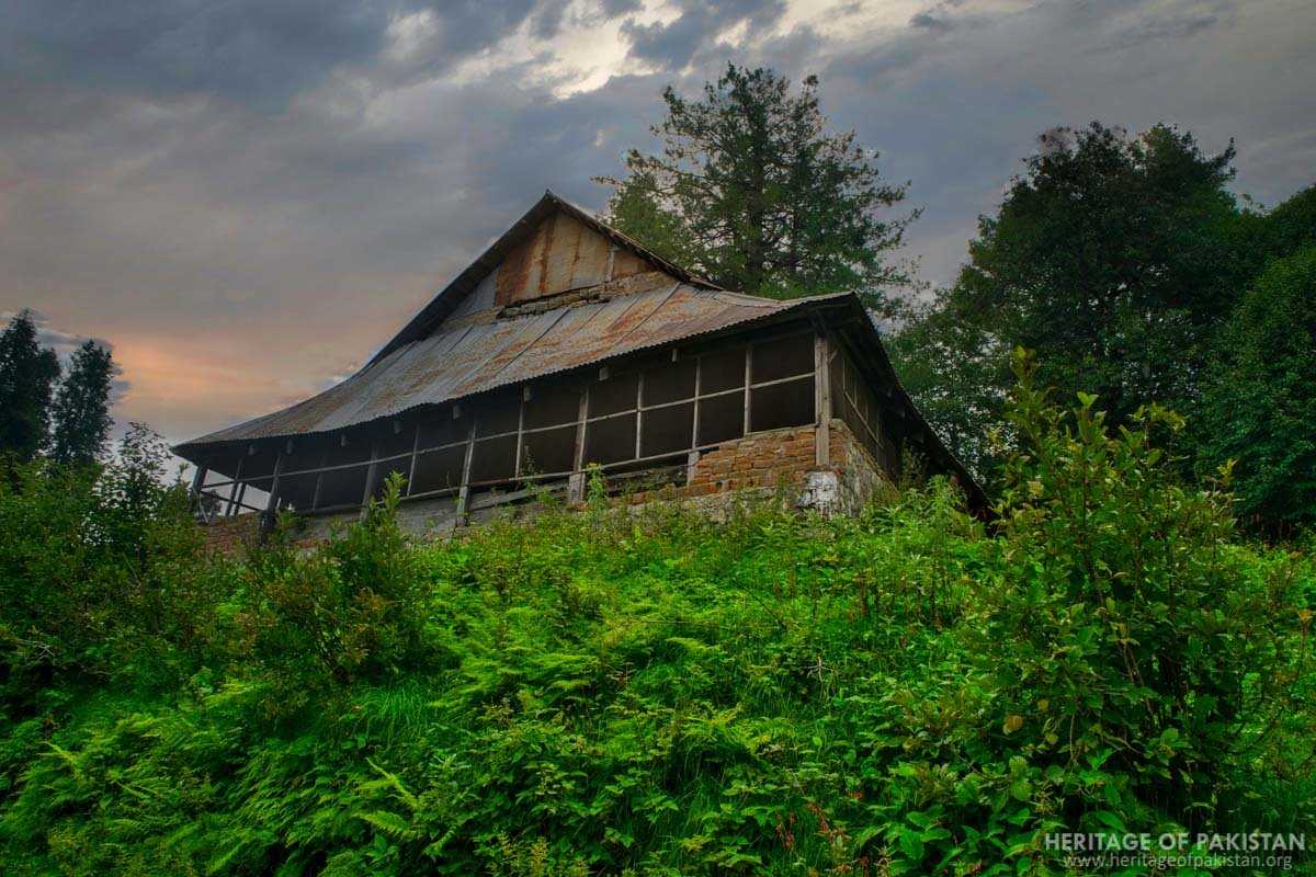
The architectural character of Abbottabad developed a distinct colonial style, with sloping gable roofs becoming an iconic feature. These roofs served both decorative and practical functions, particularly in managing rainfall and snowfall in the hilly region. Construction materials commonly used during this period included stone blocks for masonry and wood for balconies and decorative detailing. Various colonial-era structures reflected a consistency in design and function.
Notable buildings from the colonial era include the Sessions Court building, the Deputy Commissioner’s residence, the Court of the Senior Civil Judge, the former Assistant Commissioner’s Court, and the Deputy Commissioner’s Offices. Additional significant structures are the Mohafiz Khana Aam, Police Lines Reporting Room, the residence and office of the Civil Surgeon of Hazara, the villa of Shahzada Sahib of Bokhara, the bungalow of Sahibzada Abdul Qayyum Sahib, St. Luke’s Church, the Lady Garden, and the Old Tehsil building.
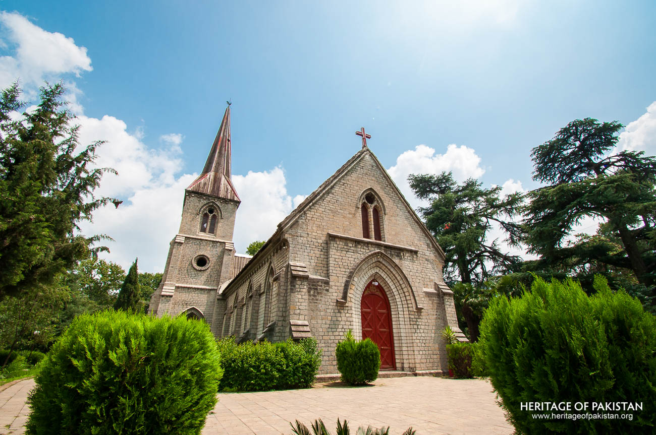
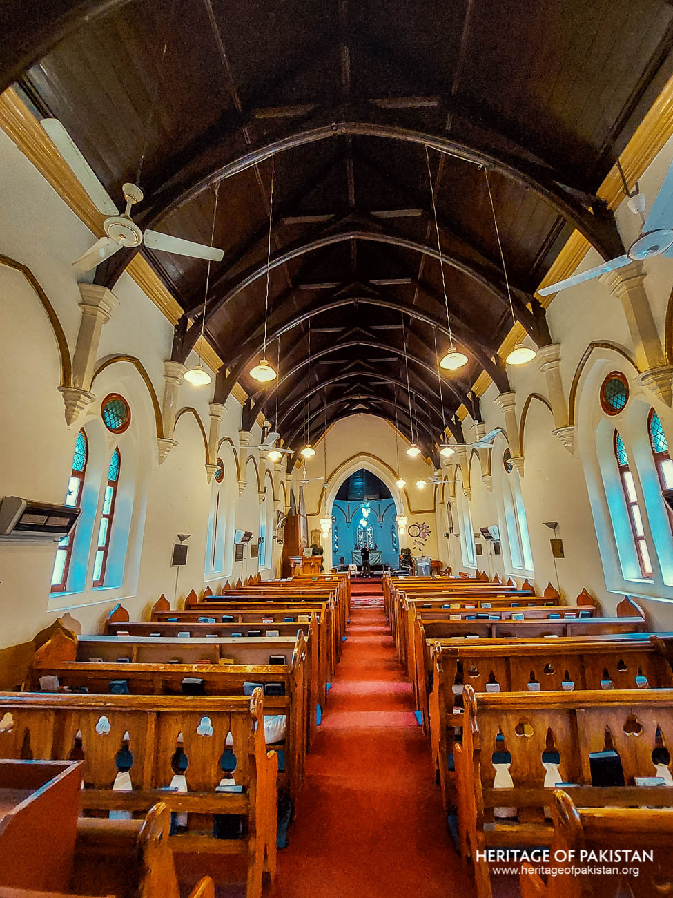
Abbottabad is also home to three British-era churches: St. Luke’s Church, St. Peter’s Canisius Church, and the Presbyterian Church. These churches serve as prominent examples of the town’s colonial religious infrastructure. St. Luke’s Church, established in 1864, is a notable Anglican church built in the Gothic style. It was originally constructed for military officers and their families and named after St. Luke, a companion of Jesus Christ. Another significant structure is the Catholic church, St. Peter’s Canisius Church, which was established in 1910 to serve Catholic soldiers of the British Army. The Presbyterian Church, while less detailed in surviving records, represents the diversity of Christian denominations present in colonial Abbottabad.
The Christian Cemetery, commonly referred to as ‘Gora Qabristan,’ was established in 1853 and is located on the road leading to Shimla Hills. The cemetery contains numerous old graves and historical memorials. Many of these graves belong to those who lost their lives during the frontier campaigns, making the cemetery an important historical site that reflects the military legacy of the region.
Another important colonial structure is the Town Hall, founded by Major James Abbott in 1853. The primary function of this hall was to receive local delegations for the resolution of regional issues. Over time, it became a central space for *jirgas* and community problem-solving assemblies. It was even used as the Provincial Assembly of the North-West Frontier Province (NWFP) for a period, reflecting its administrative and political importance.
The Lady Garden was another distinct feature of British Abbottabad, established in 1853 exclusively for British women and children. The garden included designated sitting areas, a gym, a children’s playground, and a reading room. This facility provided a social and recreational space for the British community, reinforcing the segregated social structure typical of colonial settlements.
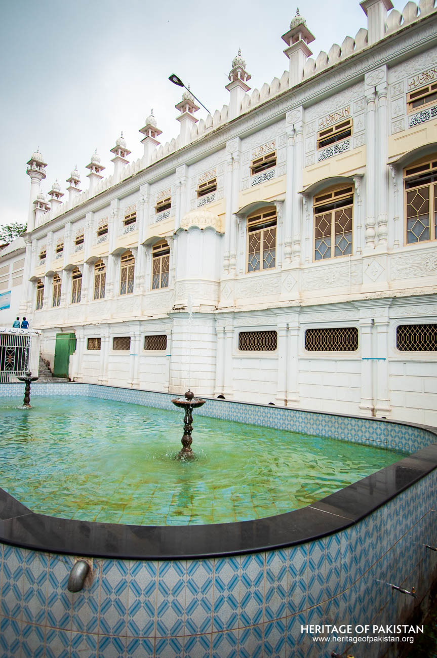
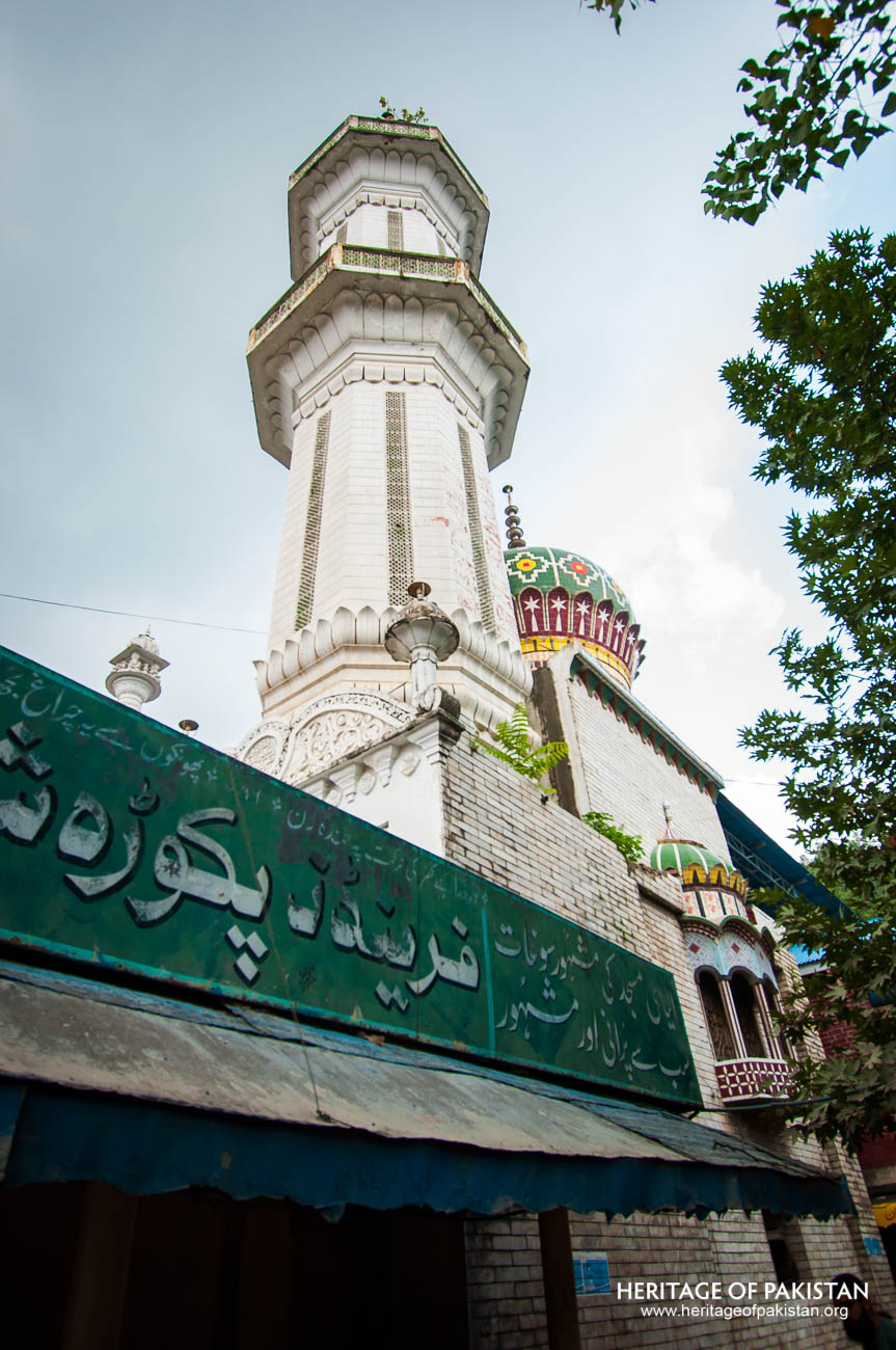
In addition to colonial landmarks, Abbottabad also features places of local religious and scenic significance. The Ilyasi Masjid is a prominent site, constructed on a natural stream that flows through a hill. This stream provides water for ablution to worshippers, and a large water tank in the mosque’s courtyard is filled by this same stream. The integration of the natural water source into the mosque’s design is a notable aspect of its construction.
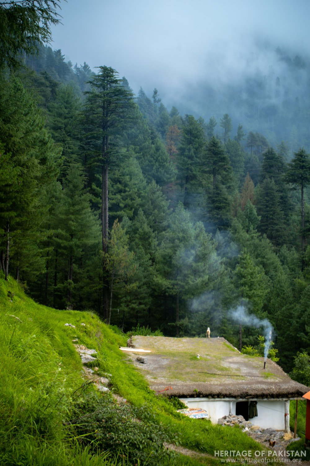
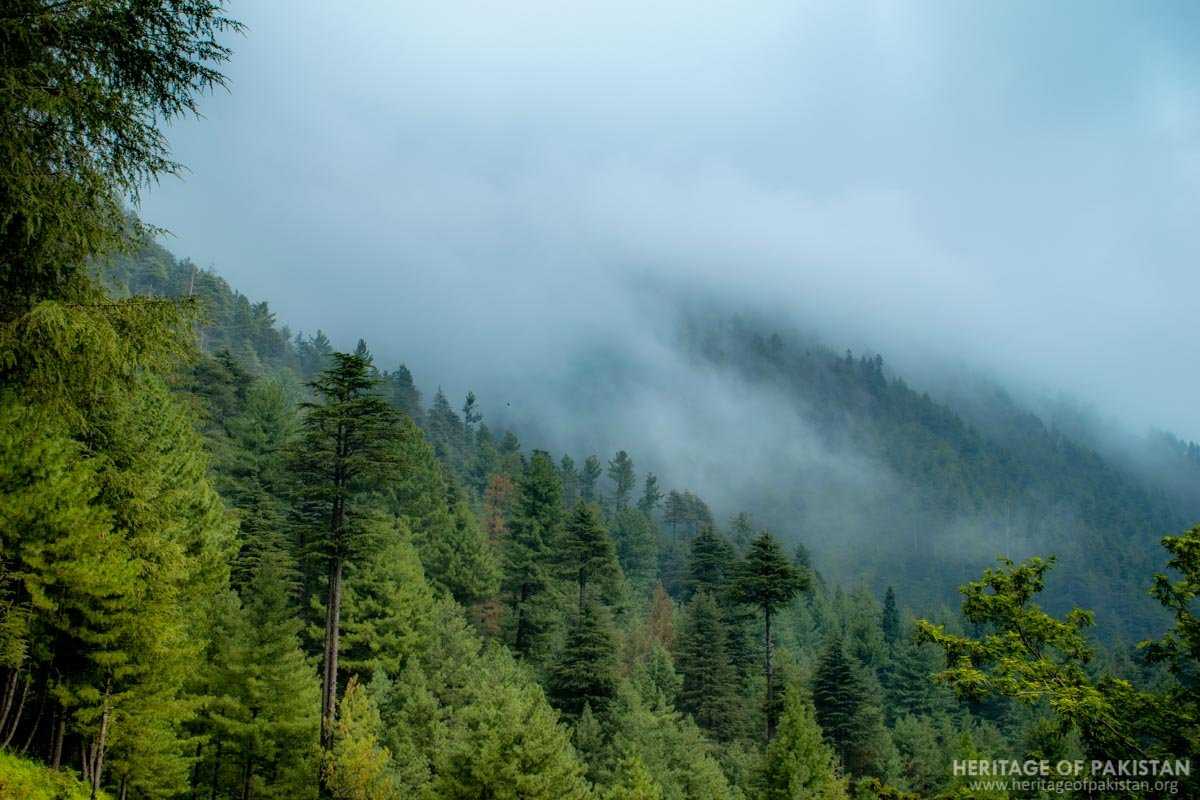
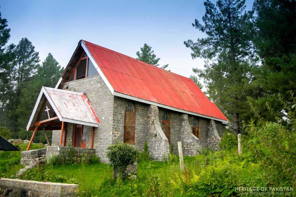
Thandiani, a hill station located near Abbottabad, is another noteworthy location. It is renowned for its consistently cool climate throughout the year. Originally established as a missionary settlement during the colonial era, Thandiani also houses St. Xavier’s Church, further illustrating the religious and administrative spread of colonial influence in the surrounding areas of Abbottabad.
All Photographs by Syed Noor Hussain and Sania Azhar.
All Rights Reserved. Photos may be used for Non-Commercial, Educational, Artistic, Research, Non-Profit & Academic purposes.
Commercial uses require licensing agreement.
syed noor
July 26, 2025 at 12:20 pms