Did You Know?
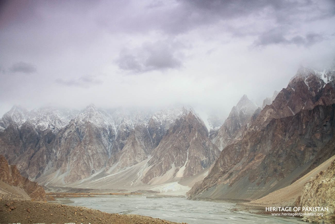
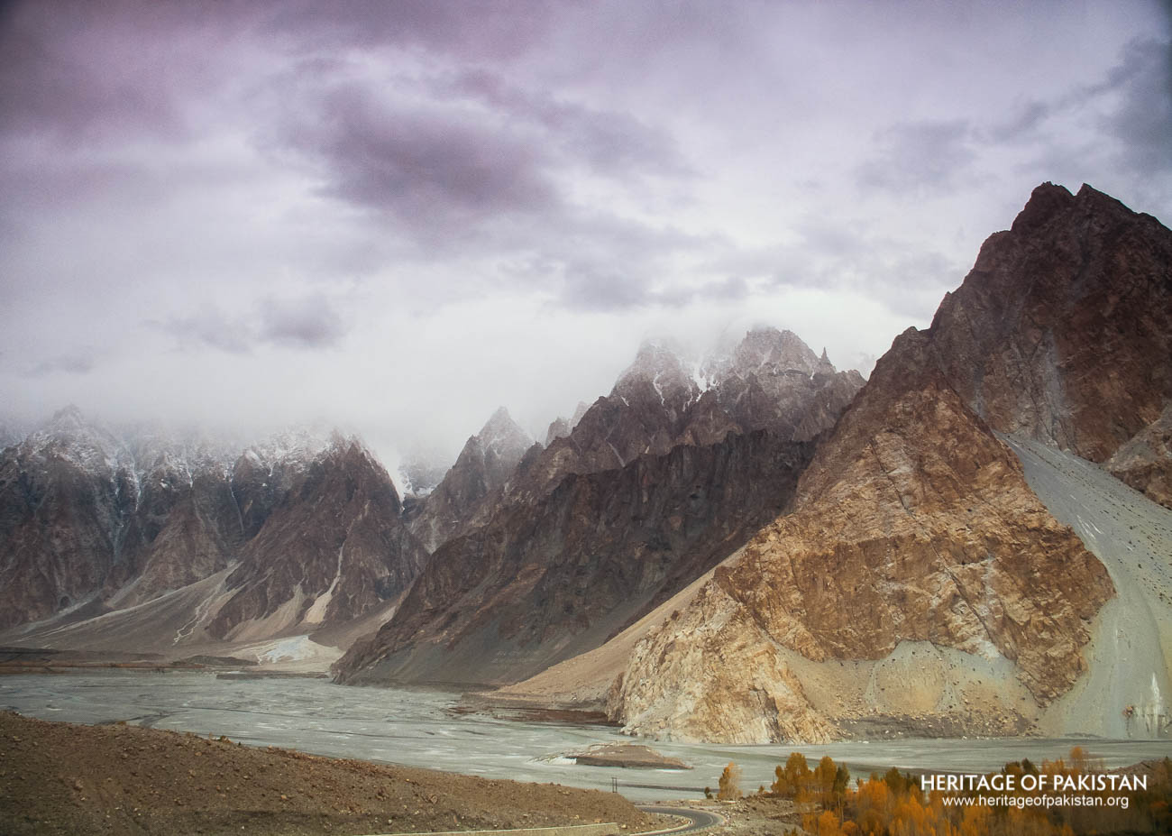
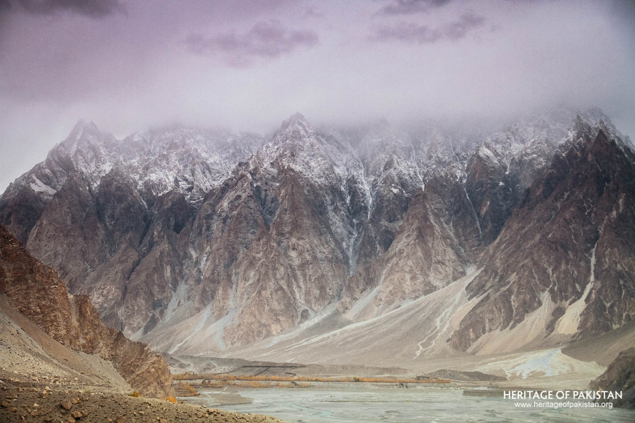
The Passu Cones resemble Gothic cathedrals and are among the most photographed mountains in Pakistan
36°27'51.0"N 74°53'33.2"E
The Passu Cones resemble Gothic cathedrals and are among the most photographed mountains in Pakistan
The Best Time to Visit Gilgit Baltistan Region is Summers. Preferably from April to September. Winters are Extremely Cold and Snowfall blocks most of access. Hence Winters are not recommended.

Passu is a small village located in the Upper Hunza or Gojal region of Gilgit-Baltistan, Pakistan. Situated in the Karakoram mountain range, it stands at an elevation of 2,489 meters, or 8,168 feet above sea level. The village lies on the western bank of the Hunza River and is accessible via the Karakoram Highway. Passu is located approximately 14 kilometers north of Gulmit and Attabad Lake. Around 124 kilometers further north lies the Pakistan–China border in the Khunjerab National Park. A road branching off near Passu leads to the Shimshal Valley, situated to the east, where the Shimshal River merges with the Hunza River.
The village of Passu is most renowned for its uniquely shaped mountain formations known as the Passu Cones, also referred to as the Passu Cathedrals. This cluster of sharply tapering peaks resembles the spires of Gothic-era cathedrals and is among the most photographed natural features in the region. The mountain formation is locally known as Tupopdan. In addition to the cones, the Passu Glacier, Passu Sar, and Batura Glacier are significant features of interest. Passu Sar is a towering mountain peak rising to 7,478 meters and lies to the west of Passu village. It is located in proximity to the Passu Glacier, Kamaris Glacier, and Batura Glacier. The first successful ascent of Passu Sar was made in 1978 by a joint Pakistani-Japanese expedition. Other prominent peaks nearby include Batura Sar at 7,885 meters and Shishper Sar at 7,611 meters.
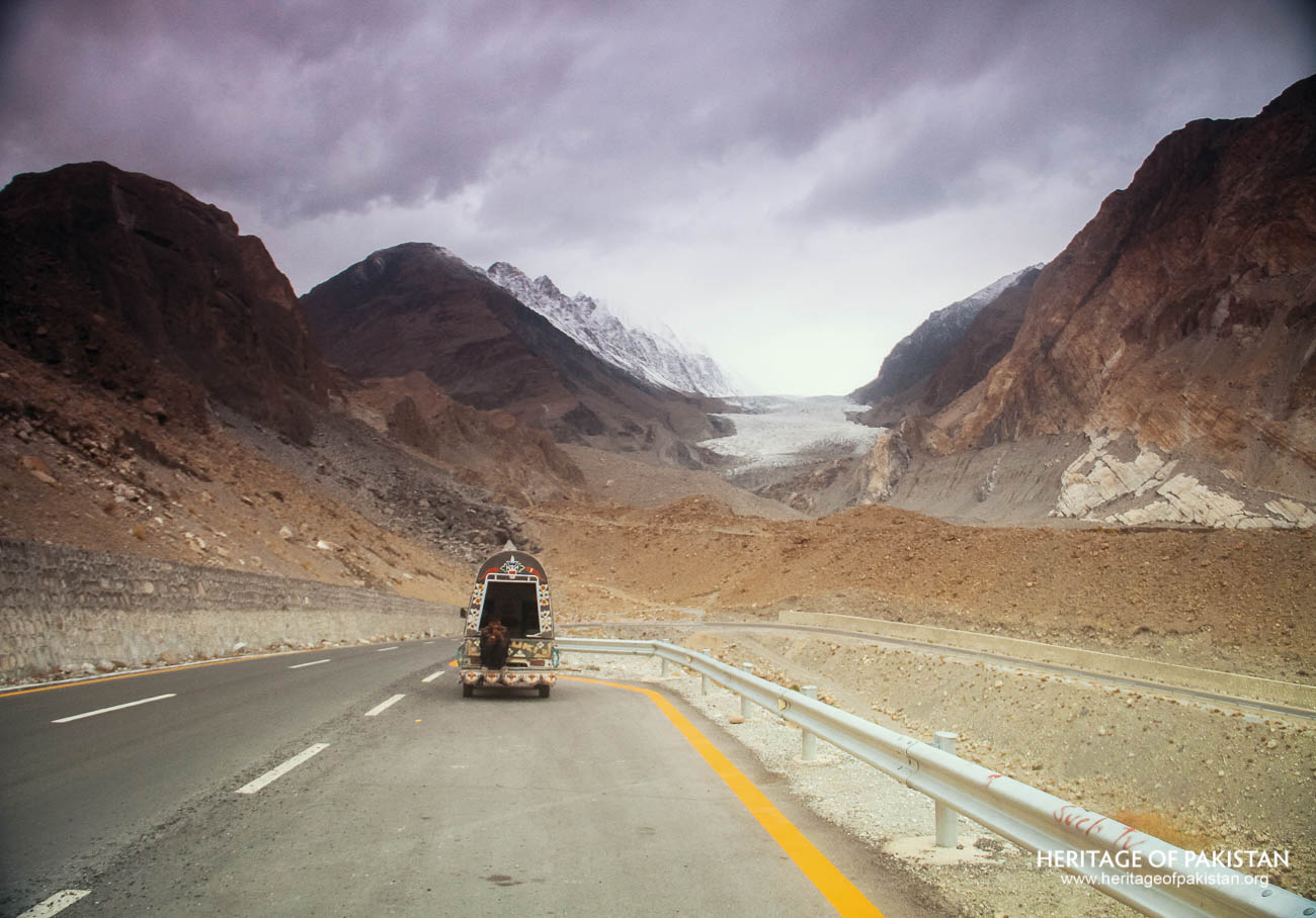
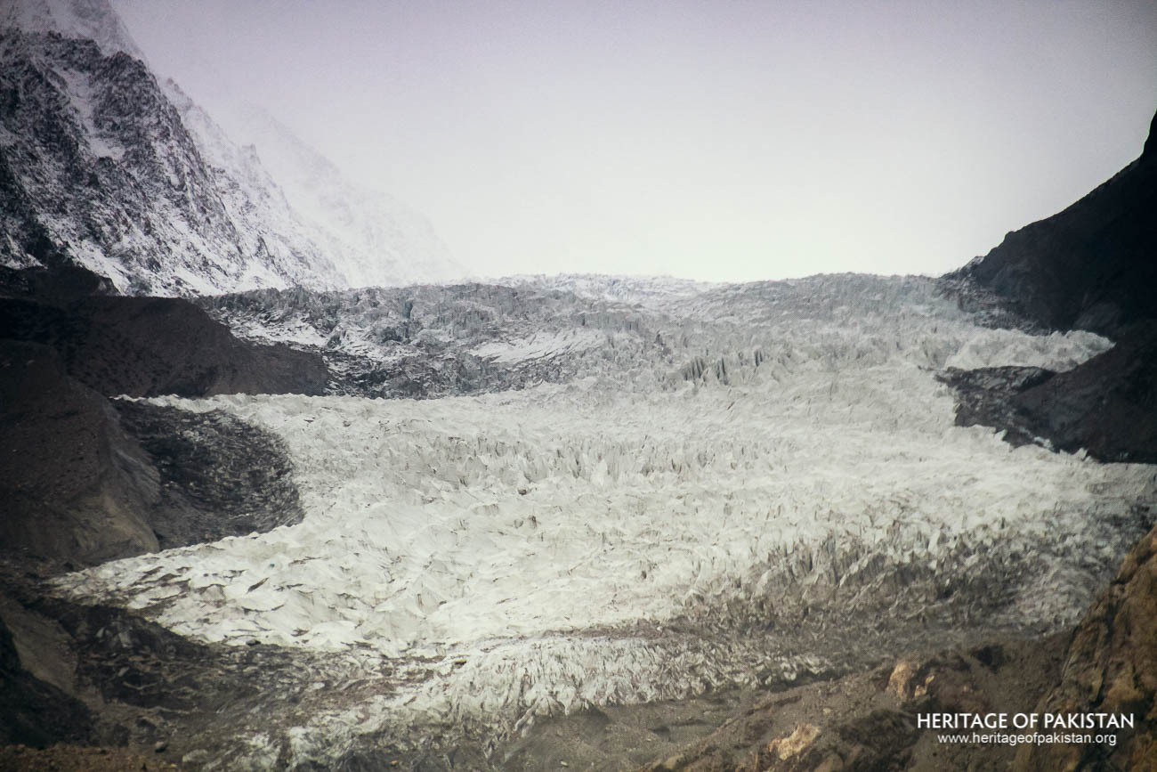
Batura Glacier lies to the northwest of Passu and stretches in an east-west direction. It is one of the longest non-polar glaciers in the world and covers an area of approximately 289 square kilometers. Research indicates that the Passu Glacier is gradually losing its ice cover, reflecting larger environmental trends in the region.
The village of Passu falls within the Northwest Karakoram climatic regime, experiencing maximum precipitation in the winter months and occasional rainfall in spring and summer. The settlement is spread across an area of approximately 1.4 square kilometers and is formed on three distinct fluvial terraces of the Hunza River. A fluvial terrace is a long, narrow strip of relatively flat land that represents a former floodplain or valley floor, uplifted or incised by river erosion. In Passu, these terraces are cultivated with crops such as potatoes and wheat, as well as fruit orchards.
Administratively, Passu was historically part of the State of Hunza under the rule of the Mirs of Hunza. Today, it comprises several sub-regions including Central Passu, Yashvenden, Janabad, and Khorumabad. Most residents live in Central Passu and Yashvenden, while Janabad and Khorumabad primarily serve as croplands and summer pastures. In 2010, the total population of Passu was recorded as 940 individuals.
The earliest recorded inhabitants of the region were the Wakhi people, who migrated from the Wakhan Corridor of Afghanistan. Locals often refer to Passu as the “Sih Sad Khona” village. Due to its precarious geographical position, the village has suffered repeated destruction from floods and glacial lake outburst events. The broader Hunza region comprises two major ethnic groups: the people of Upper Hunza, who are predominantly Wakhis, and those in Lower Hunza, who are mainly from the Baltistan region. The Wakhi language belongs to the Eastern Iranian language family, whereas the language spoken by people in Baltistan is closely related to Indian linguistic traditions.
In the Gojal region, where Passu is located, the population is entirely Ismaili, regardless of ethnic affiliation—be it Wakhi, Kyrgyz, Brusho, Shina, or Dom. A defining element of the community's identity is their religious belief system known as Dawat-i Nâsir. This shared religious affiliation forms a significant aspect of the cultural cohesion in the area.
All Photographs by Syed Noor Hussain and Sania Azhar.
All Rights Reserved. Photos may be used for Non-Commercial, Educational, Artistic, Research, Non-Profit & Academic purposes.
Commercial uses require licensing agreement.
Add a review