Protected Under
Antiquities Act 1975
33°45'21.5"N 72°49'45.6"E
![]()
On the UNESCO World Heritage Site List
Antiquities Act 1975
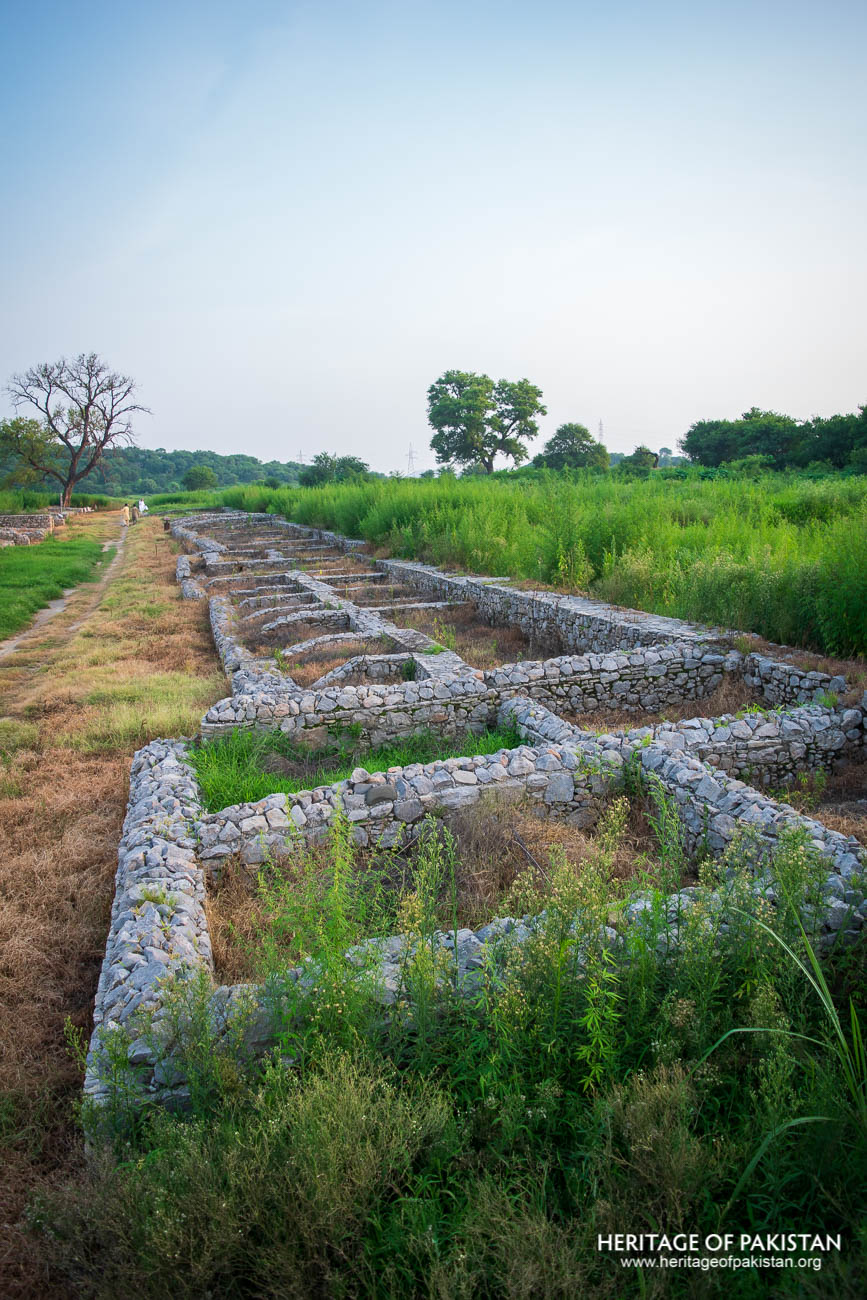
Sirkap is one of the few ancient cities in South Asia built on a Greek Hippodamian grid plan, showcasing a rare fusion of Hellenistic and South Asian urban design
The Best Time to Visit Punjab Province is Year long as it has bearable Cold winters and Hot Summers. However, Summers can get really Hot and precautions are recommended during Daytime visits.

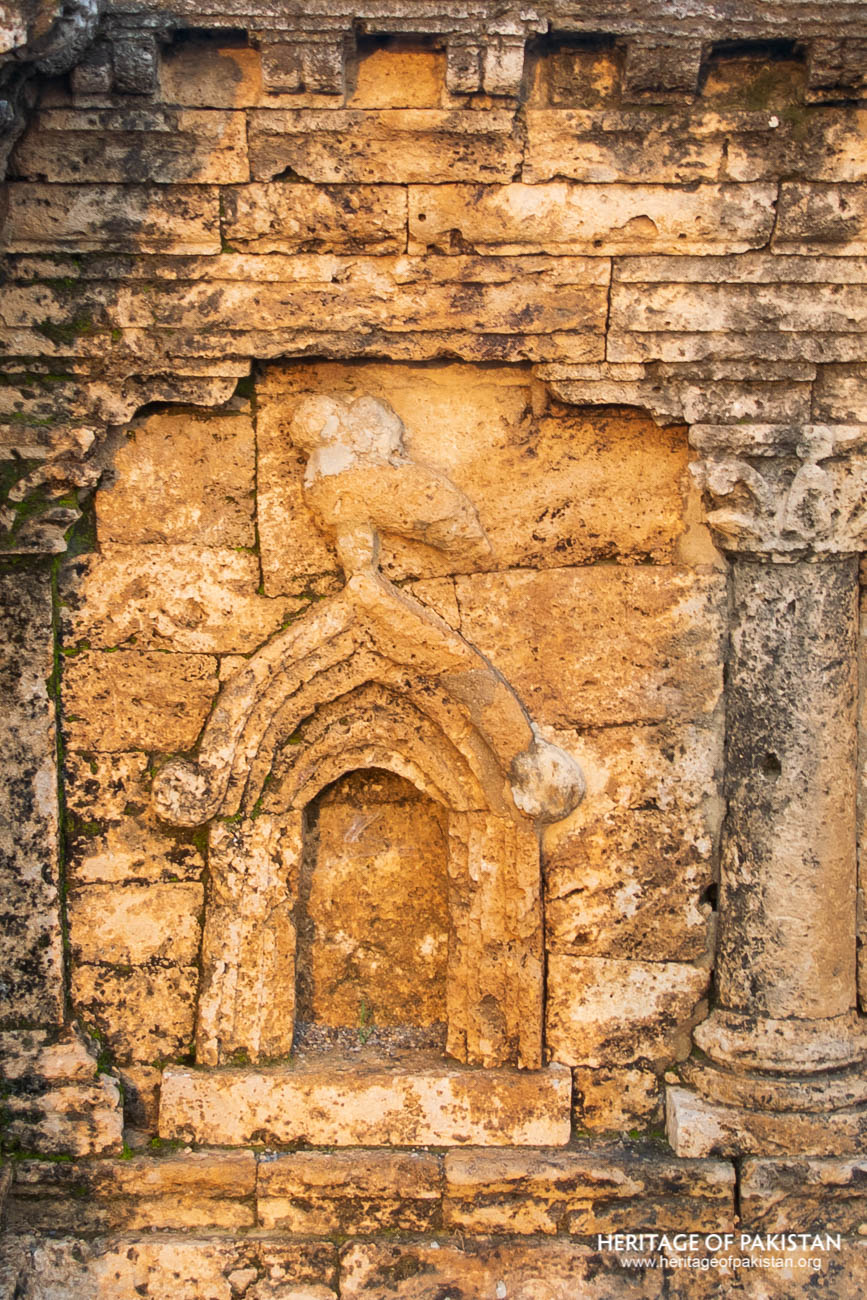
Shrine of Double Headed Eagle, Sirkap
Sirkap, an ancient city located in the Taxila Valley of present-day Pakistan, was founded by the Bactrian Greeks in the 2nd century BCE. It represents the second major urban center of Taxila, following Bhir Mound, which had been established in the 6th century BCE by the Achaemenids. Sirkap was laid out on a well-planned urban grid, with streets intersecting at right angles and building blocks aligned in a regular fashion. This structural layout reflects the influence of Hellenistic town planning. The city included residential quarters, religious structures, and larger residences that likely belonged to individuals of considerable influence. Among the findings from the site are items of jewellery and silverware, including gold earrings, bangles, necklaces, and pendants.
The foundation of Sirkap came after the Bactrian Greeks conquered the earlier Achaemenid settlement at Bhir Mound. Following a temporary occupation of Bhir, the Indo-Greek king Menander I established the city of Sirkap around two kilometers to the west. The Indo-Greeks ruled Sirkap for approximately a century, until 90 BCE, when they were displaced by the Scythians and Parthians. These new rulers constructed their own settlements atop the remains of the earlier city. The site eventually came under the control of the Kushans, who remained in power until around 80 CE. It was during their reign that the capital was shifted to a newly established city, Sirsukh, marking the third major city of Taxila. Nevertheless, partial occupation of Sirkap continued even after the move.
 Ruins of Sirkap City, Taxila
Ruins of Sirkap City, Taxila
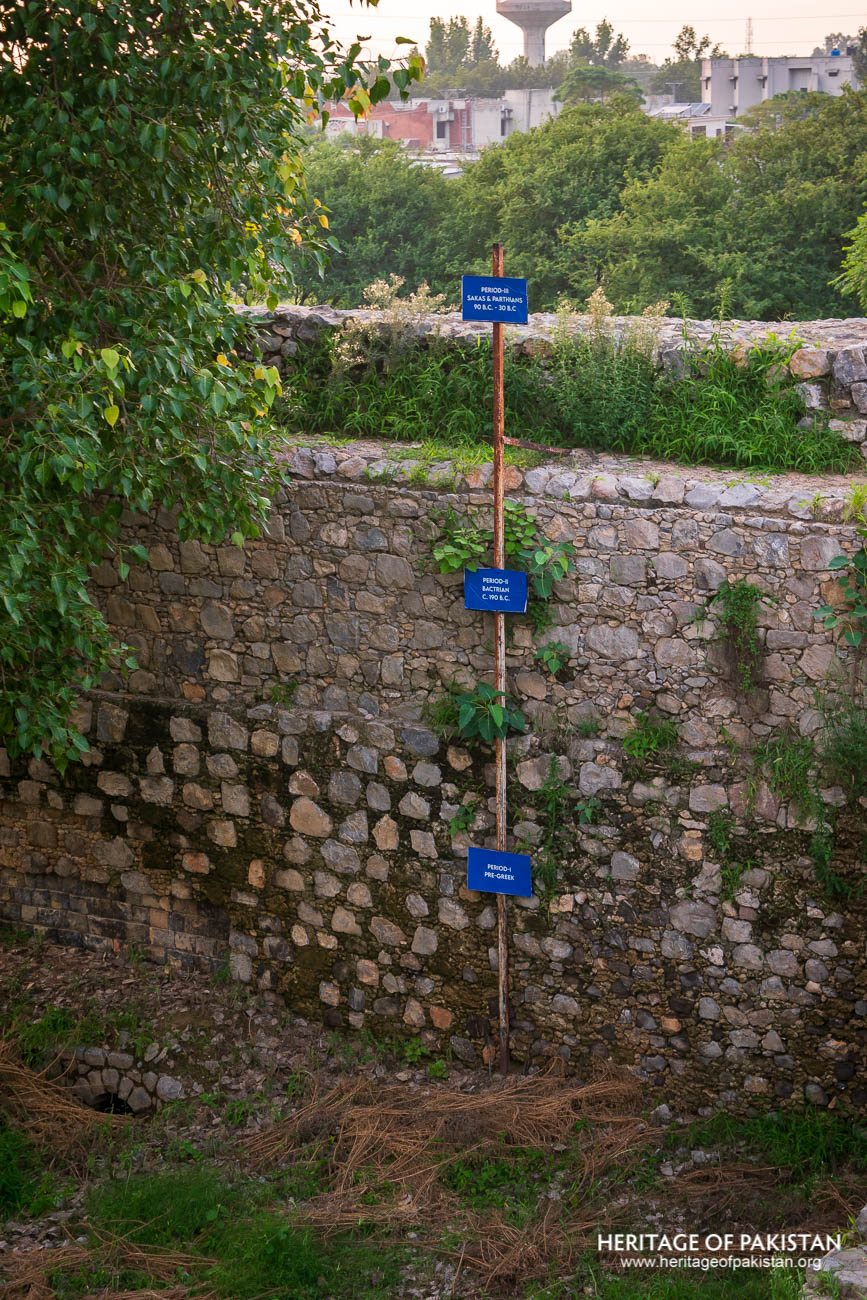
A notable feature of the site is a deep vertical trench that reveals seven distinct archaeological layers, representing approximately 400 years of continuous urban development. A long vertical rod with labeled markers guides visitors through the various stages of the city’s evolution, which is also evident in the differing masonry techniques of each layer. The earliest layer indicates a pre-Greek settlement. The sixth and fifth layers correspond to the Bactrian Greek city, dating from approximately 190 to 90 BCE. The fourth to second layers represent the Saka period, from 90 to 25 BCE. The uppermost layer belongs to the period of Kushan occupation. The most visible ruins at the site today originate from the second stratum.
Sir John Marshall carried out extensive excavations at Sirkap between 1918 and 1934, revealing a comprehensive picture of the city's historical and architectural development. About one kilometer from the northern gate of Sirkap lies the Jandial Temple, which is Greek in character and was constructed contemporaneously with the city. The temple's architectural style further reinforces the Hellenistic cultural influence prevalent during the early phases of Sirkap’s history.
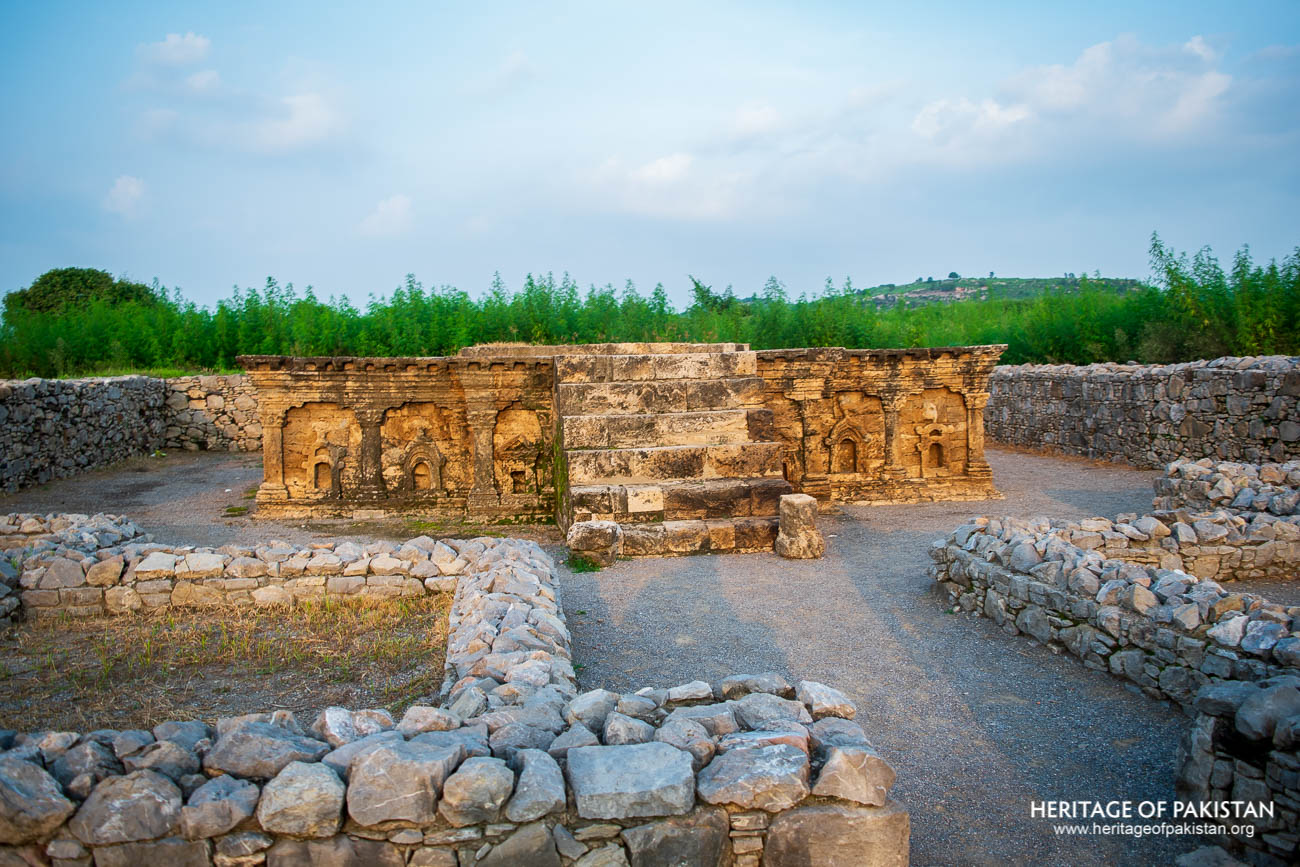
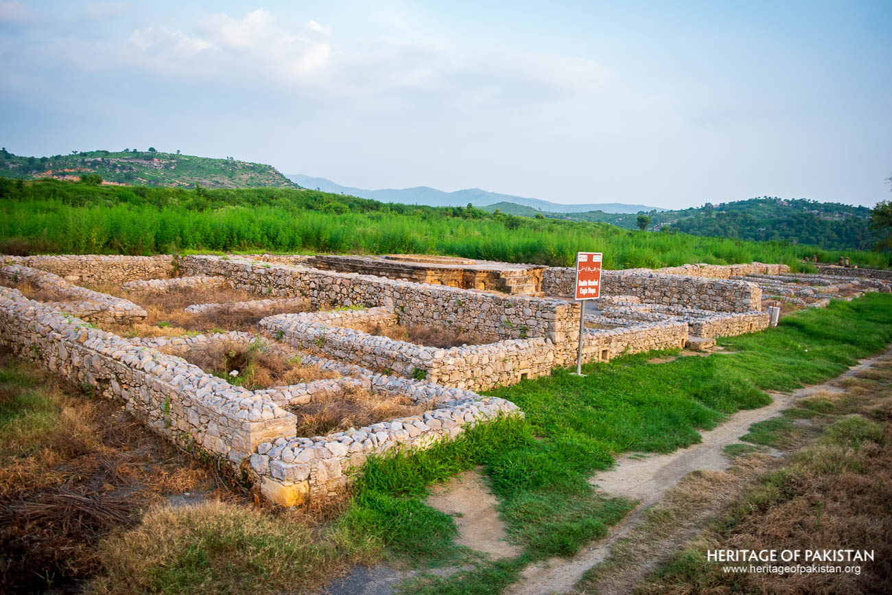
Sirkap was built on a Greek Hippodamian grid with a main avenue and intersecting streets. It was enclosed by a 5-kilometer defensive wall with rectangular bastions. Key structures include a palace complex, a Jain temple with Persepolitan columns, a Parthian-era Buddhist apsidal temple, and the Temple of the Double-Headed Eagle
Settlement layers of Sirkap city, Taxila
Sirkap, a Hellenistic city founded by the Bactrian Greeks in the Taxila Valley, was a planned urban settlement characterized by deliberate city design and fortified construction. The site was carefully selected by Greek planners, and the city was laid out on the “Hippodamian” grid plan, a hallmark of classical Greek urbanism. This plan, similar to that of the ancient Macedonian city of Olynthus, centered around a main avenue running in the north–south direction, intersected by fifteen perpendicular streets. This network structured the city into regular blocks and allowed for systematic placement of residential, commercial, and religious buildings. Shops were aligned on both sides of the main street, contributing to the city’s commercial activity.
The surrounding fortification wall was constructed using coarse rubble masonry with locally sourced stone. It encircles the city for approximately five kilometers, with its thickness varying between 4.5 and 6.5 meters. The wall runs straight along the northern and eastern sides of the city and features rectangular bastions placed at regular intervals to strengthen its defensive capabilities. Ihsan H. Nadeem notes that there are reasons to believe that the city had four entry gates, although only one has been excavated on the northern side. He also mentions that the Greek philosopher Apollonius of Tyana, upon visiting Taxila in the 1st century AD, described its Greek construction, which most likely referred to Sirkap.
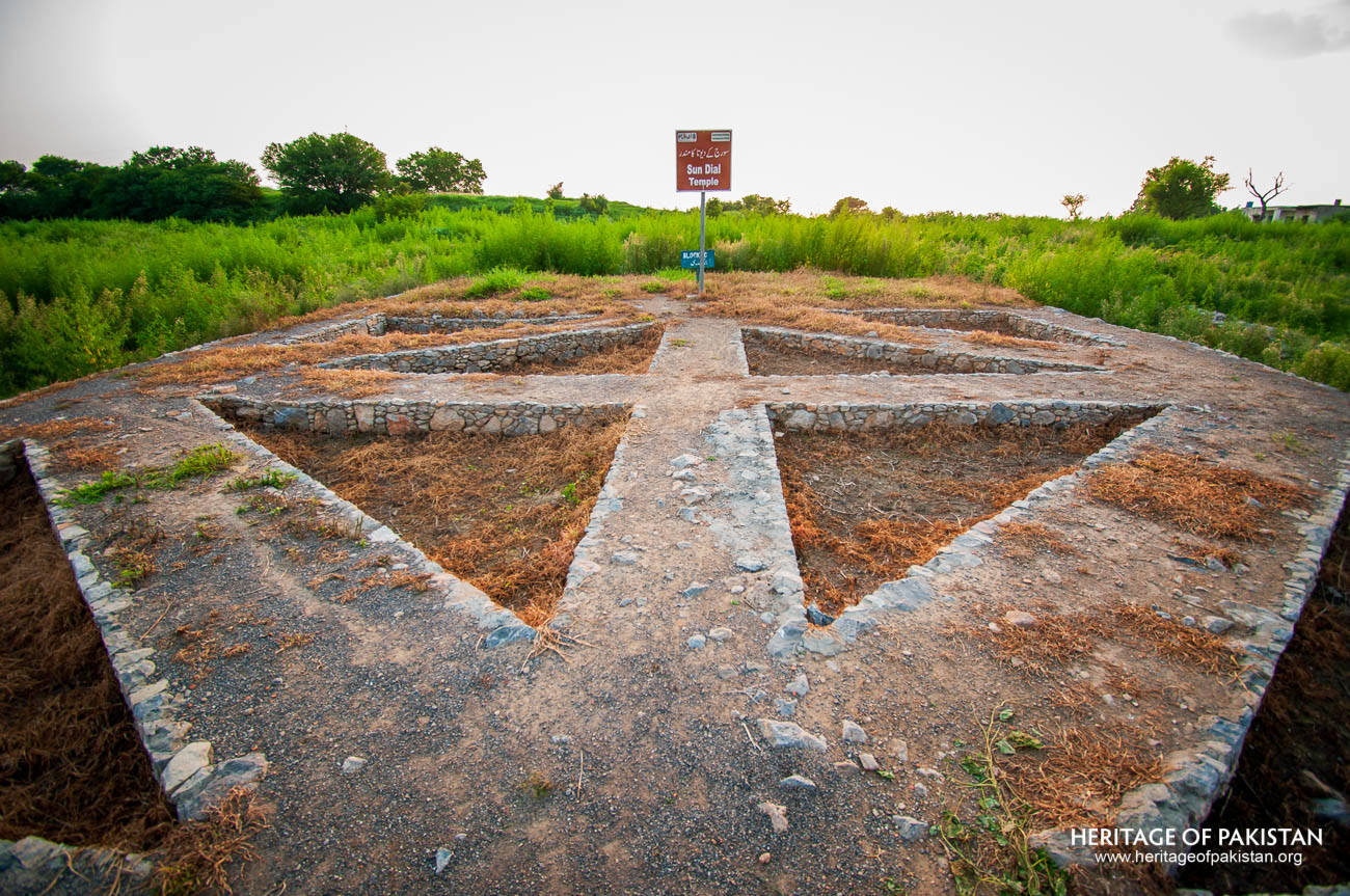
Sun Dial temple at Sirkap, Taxila
Ruins of Sirkap, Taxila
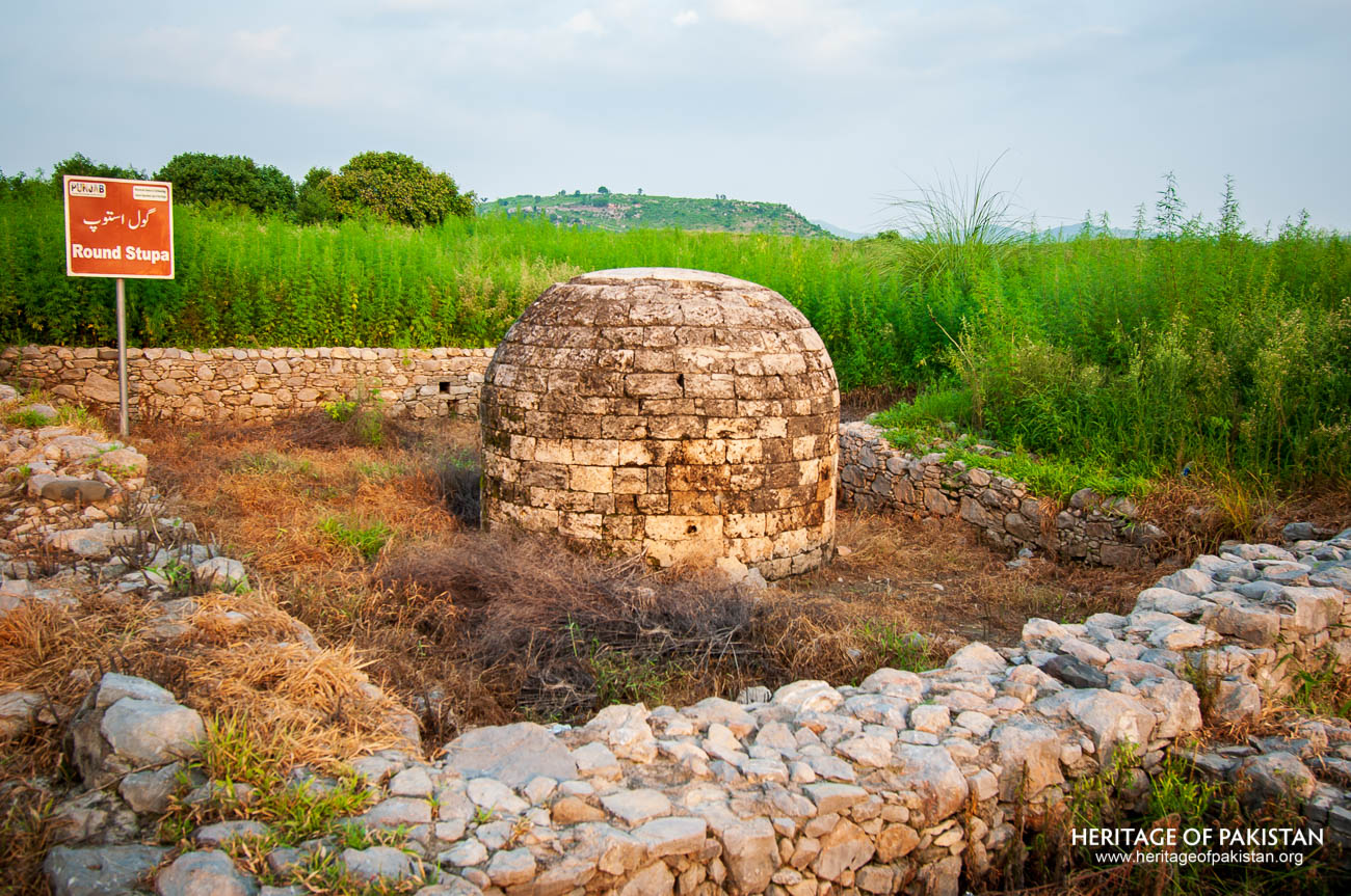
Excavated Round Stupa at Sirkap, Taxila
Within the city, several significant structures have been uncovered, revealing the cultural and architectural diversity of its successive periods of occupation. Among them is a palace-type structure located on the southern end of the city. Its earliest components date to the Scytho-Parthian period, with later additions indicating continuous use. Sir John Marshall described the palace as comprising five series of apartments built around a central courtyard. It contained women’s quarters, a hall for public audience, offices, guest chambers, and a court for special audience. Marshall noted that the architectural design of the palace bears resemblance to the Assyrian palaces of Mesopotamia.
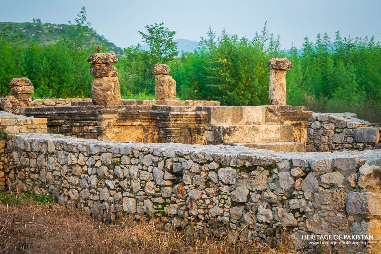
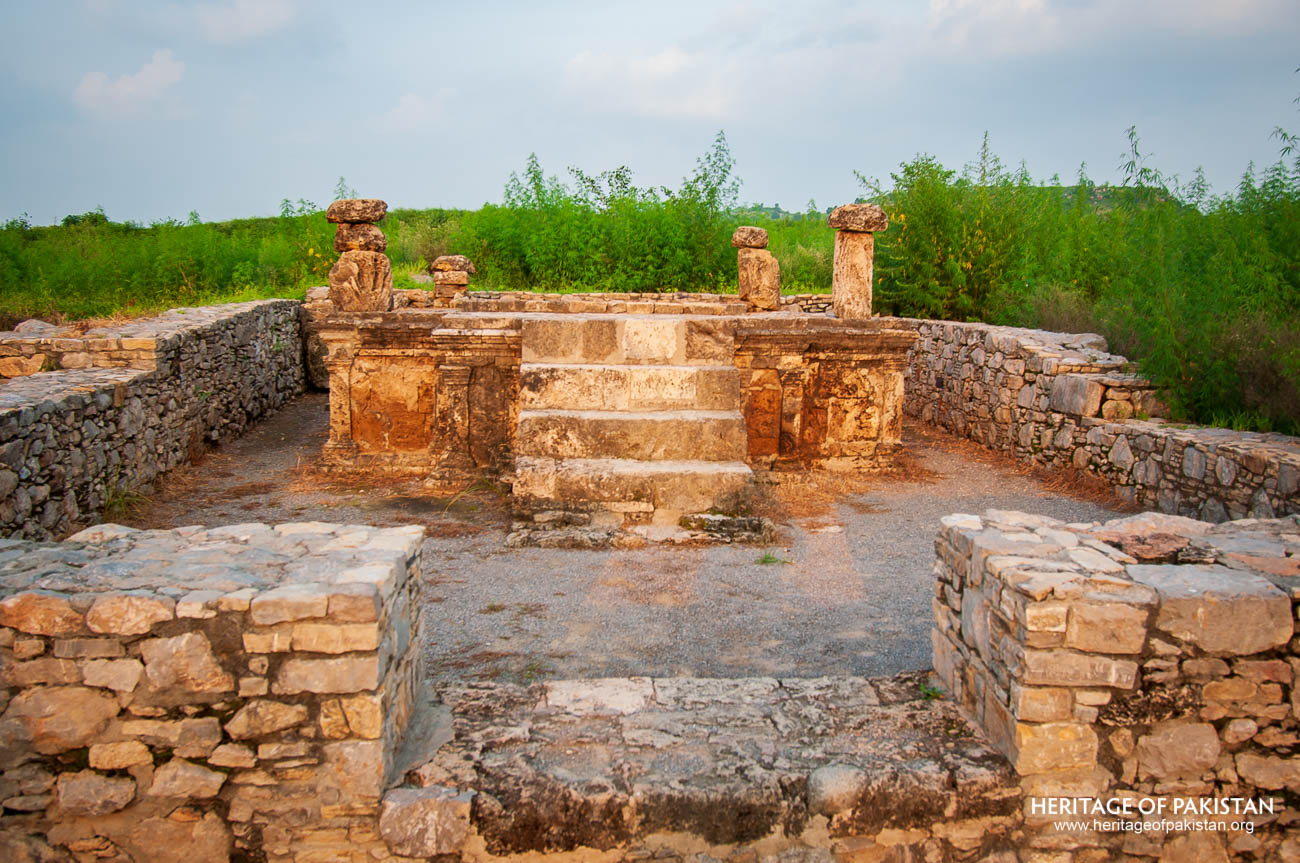
A number of religious structures have also been excavated at the site, each reflecting the syncretic nature of Sirkap’s urban culture. A Jain temple, located along the main street, has been uncovered. Although the superstructure has not survived, Persepolitan columns adorned with lion decorations were found in the courtyard and reinstalled at the site during excavations. A Buddhist apsidal temple has also been revealed, featuring a stupa set within a spacious courtyard. This temple was constructed by the Parthians in the 1st century AD over earlier Saka-period buildings, which had been destroyed in a massive earthquake. Two smaller stupas flanked the main entrance of the complex.
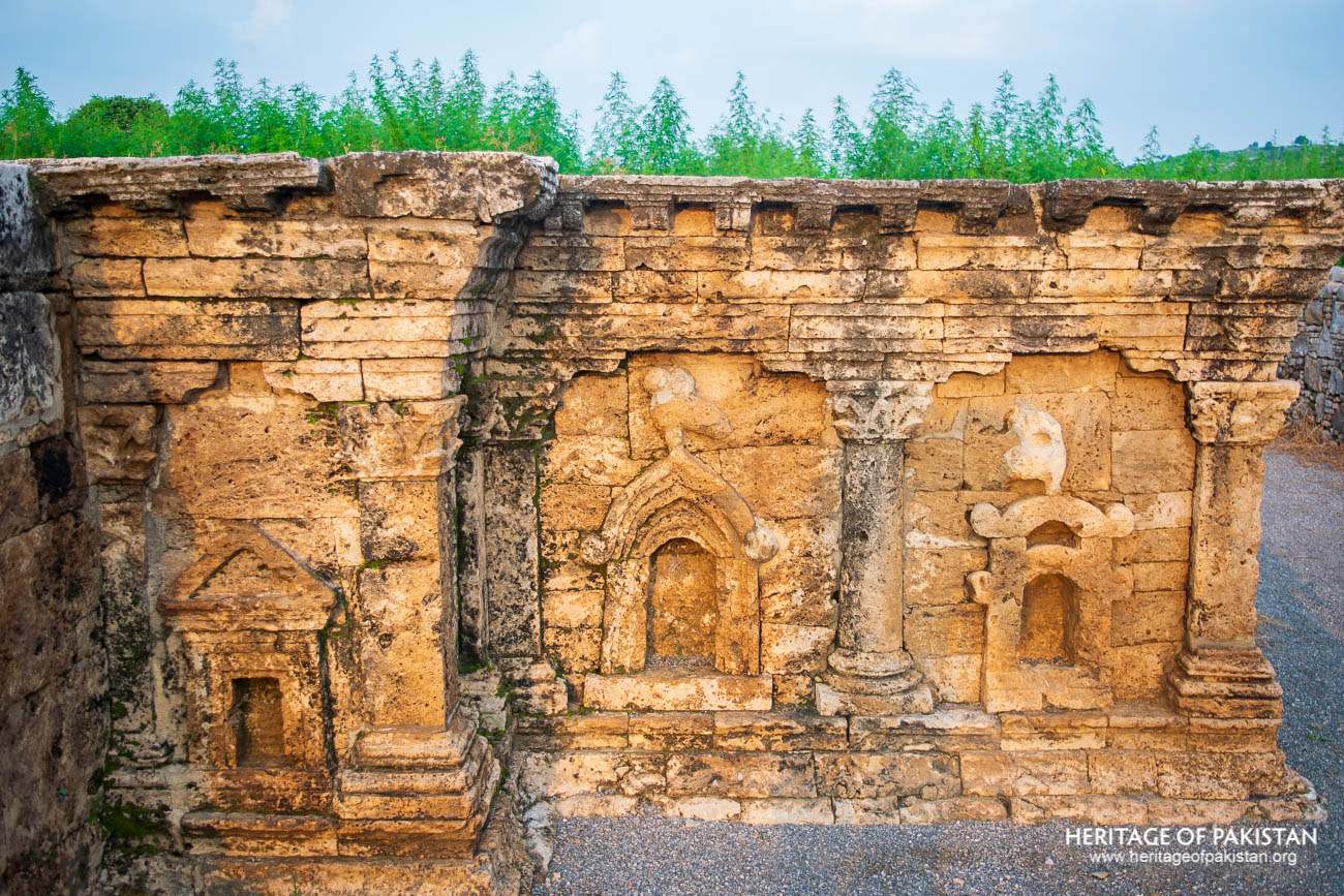
Another notable structure at Sirkap is the Temple of the Double-Headed Eagle. This building dates to the Parthian period and features a base with three arches from three different architectural traditions. The central arch is distinguished by a bird figure at its crown. The double-headed eagle symbol, though also found in monuments in Babylon and Sparta in Greece, is generally associated with the Sakas (Scythians). An Aramaic inscription discovered within the temple states that a pillar was erected in honor of a high official when "Priyadarsi," the crown prince Asoka, was governor of Taxila. Only the drum of the associated stupa remains today; the dome and relic chamber have been lost. The drum features Hellenistic decorative elements, with various panels separated by Corinthian pilasters.
These architectural and archaeological remains provide insight into the planning, construction, and cultural dimensions of Sirkap, highlighting the city's role as a confluence of Hellenistic, Central Asian, and South Asian traditions.
All Photographs by Syed Noor Hussain and Sania Azhar.
All Rights Reserved. Photos may be used for Non-Commercial, Educational, Artistic, Research, Non-Profit & Academic purposes.
Commercial uses require licensing agreement.
Syed Noor Hussain
July 23, 2025 at 4:05 amBest